Your client picked the design. Your crew hit rock at 18 inches.
Now the timeline is blown and the homeowner is calling.
We eat limestone for breakfast.
Hydraulic rock hammer. On-site rock mill. Pre-excavation 3D subgrade model. You see the limestone shelf in 3D before your crew shows up. No surprises. No change orders. No broken rental equipment.
Hill Country builds
break contractors.
You don't need us to tell you Austin's geology is unforgiving. You've watched timelines evaporate, rental equipment fail, and homeowners lose confidence — all because nobody scanned the ground before the first bucket moved.
Your standard excavator breaks teeth on flint limestone that nobody mapped. The rental company won't cover the damage. The homeowner's custom pool is now three weeks behind and you're eating the overrun.
Without knowing what's under the surface, every quote is a guess. Guess low and you lose money on rock removal. Guess high and you lose the bid. You need subsurface intelligence before you price the job.
Premium builds in Lakeway and Westlake mean excavating within feet of existing foundations, retaining walls, and neighboring structures. Standard equipment creates liability you can't afford on a $150K+ pool project.
One partner from scan to shell.
Most pool builders juggle a clearing crew, an excavation sub, and a grading crew — and pray they communicate. ClearGround handles the entire ground phase with a single mobilization, a single scan, and a single handoff.
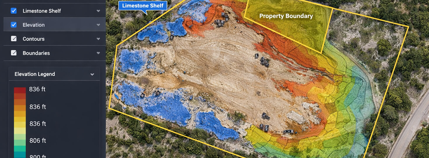
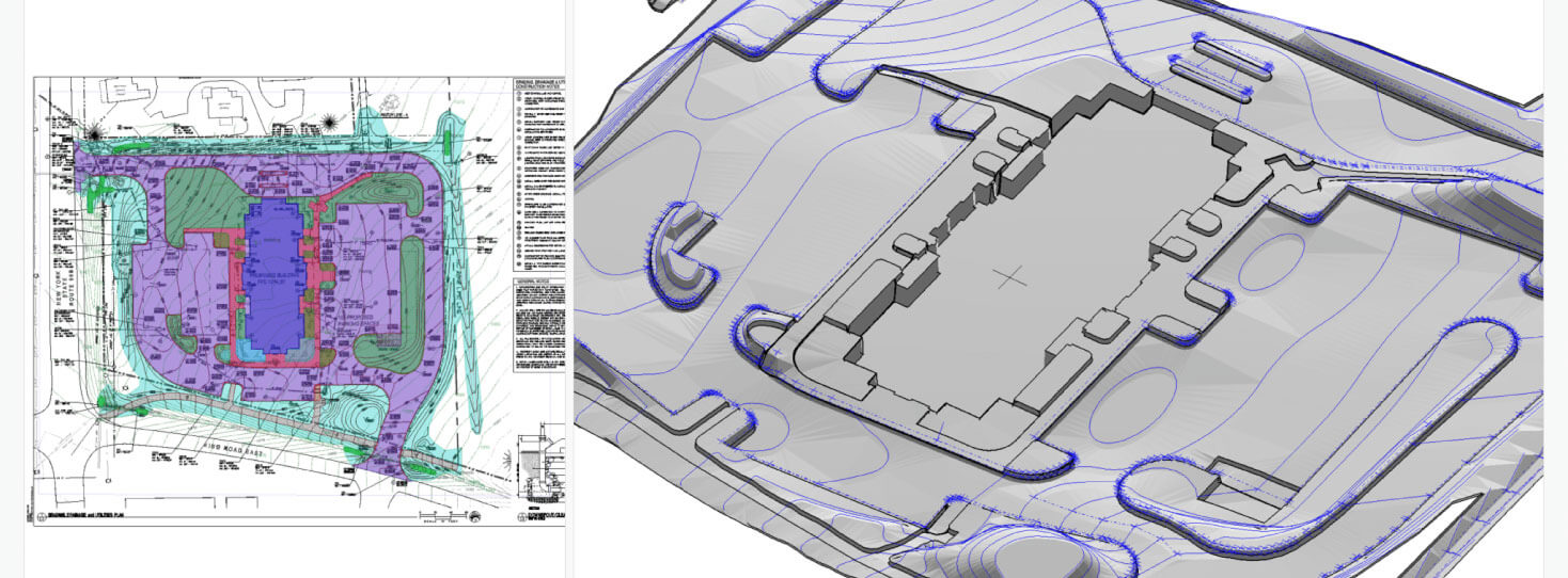
We scan your site with a Mavic 3 Enterprise RTK drone. You see the limestone shelf, root zones, and drainage flow lines in 3D before a single bucket moves.
Vegetation removed. Stumps grubbed. Rock milled on-site as aggregate base. Site cleared to construction-ready grade with heritage trees protected.
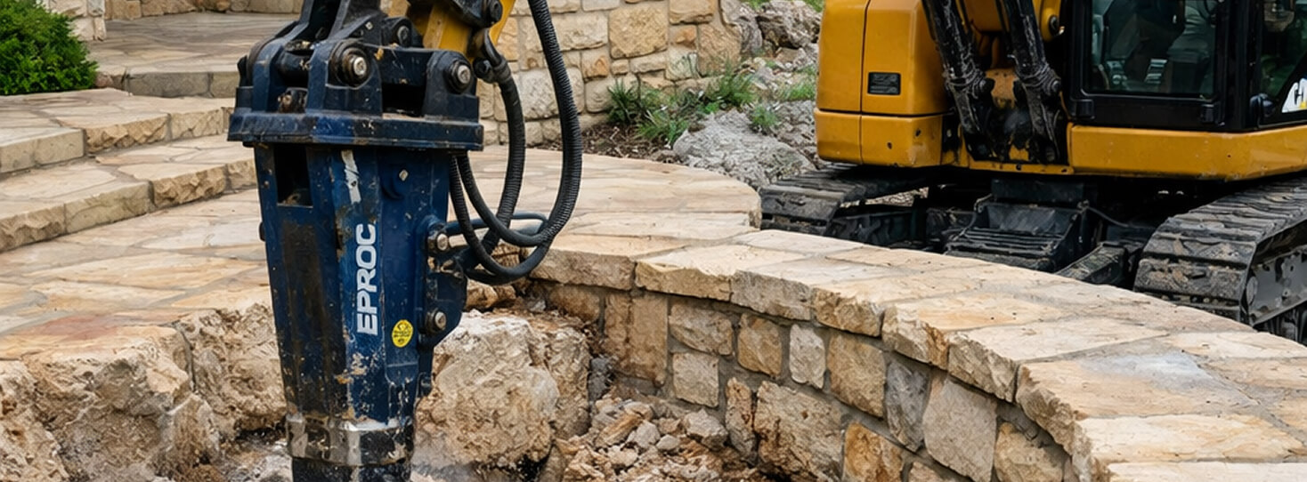
CAT 308E2 CR with NPK hydraulic rock hammer. Precision shell excavation through limestone with low-vibration protocol next to existing structures.
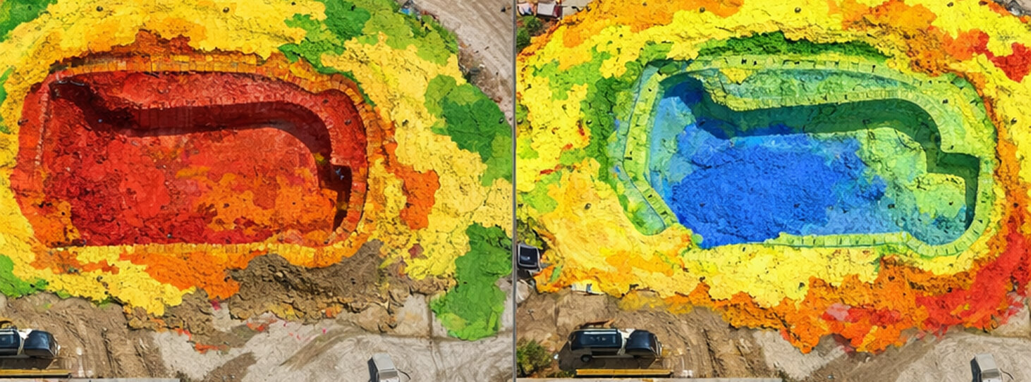
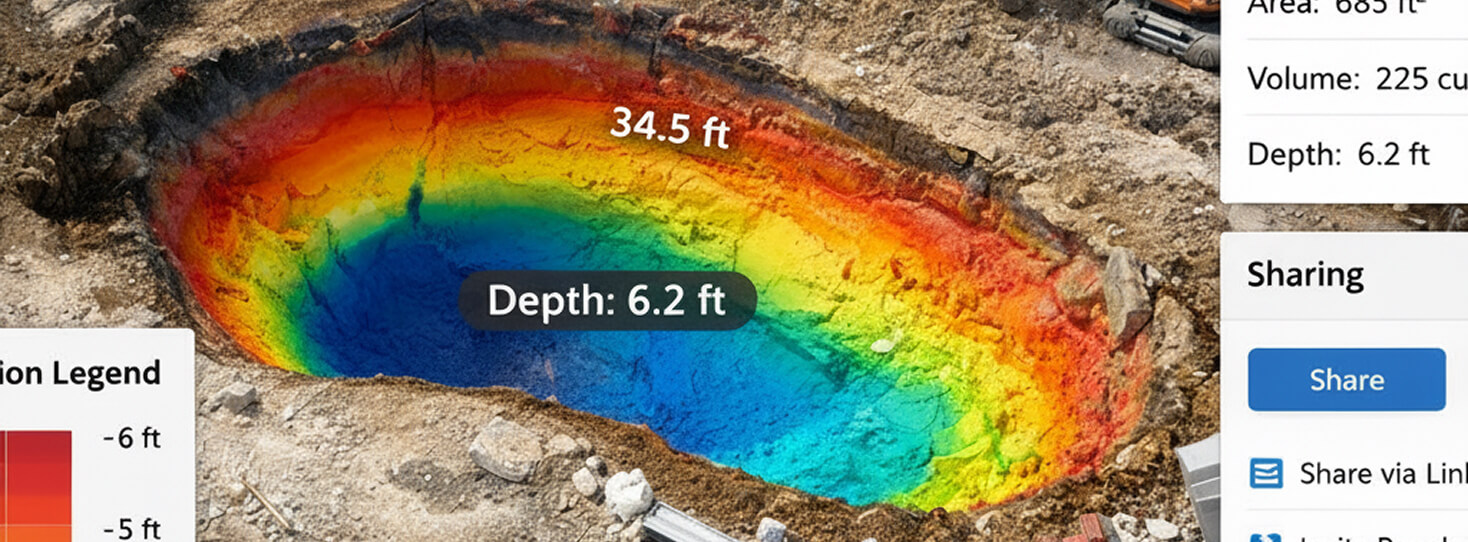
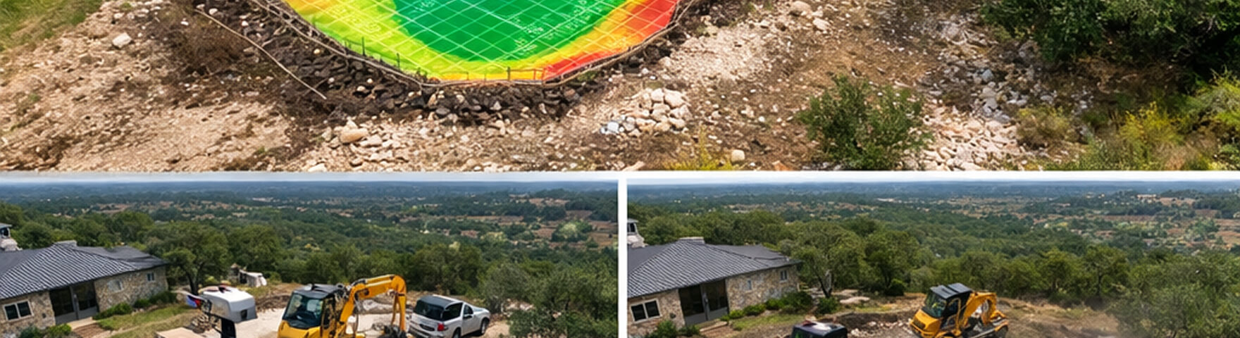
Around the pool shell. Cut/fill verified to plan with RTK. Drainage modeled. Grade confirmed before the next trade arrives.
Georeferenced 3D model delivered on DroneDeploy. Shareable with your client, your engineer, or your GC. Measurable. Permanent.
At any phase of your pool build
get an unbiased view of your site
We scan
before we dig.
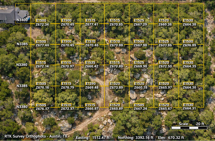
You see the limestone shelf in 3D before your crew shows up. Our Mavic 3 Enterprise RTK drone maps the site to ±0.5cm horizontal accuracy — rock shelves located, root zones mapped, drainage flow lines modeled. Every variable that causes change orders on other jobs gets accounted for on this one. You bid with data, not a gut feeling.
What changes when you
scan before you dig.
Before you break ground, you see the rock. Limestone shelves, flint layers, root zones — all mapped to centimeter accuracy. Your bid is based on data, not hope. No more eating overruns because nobody checked what was under the surface.
Our FAE rock crusher processes limestone on-site as reusable aggregate base. Eliminates $500–$2,000 in hauling and disposal costs per job. Material that used to leave your site in dump trucks now stays as structural backfill.
Premium builds in Lakeway and Westlake mean working within feet of existing foundations and retaining walls. Our NPK hydraulic hammer with chisel bit breaks rock without the concussive impact that cracks neighboring structures. Precision, not percussion.
Your homeowner gets a shareable 3D model of their completed excavation. Your engineer gets verified grades. Every cubic yard accounted for. Every depth verified. The kind of documentation that turns your one-time client into a referral source.
Iron built for Hill Country rock.
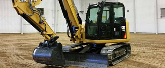
Purpose-built for tight residential sites. Compact radius swing means full excavation power within feet of existing structures, fences, and retaining walls. Your pool site in Westlake with 8 feet of clearance? This machine was designed for exactly that.
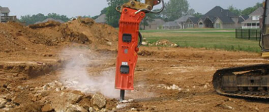
When the geology fights back. Flint limestone, blue rock, and ledge formations that stop standard excavation. The chisel bit configuration breaks rock precisely without the concussive vibration that damages adjacent structures.
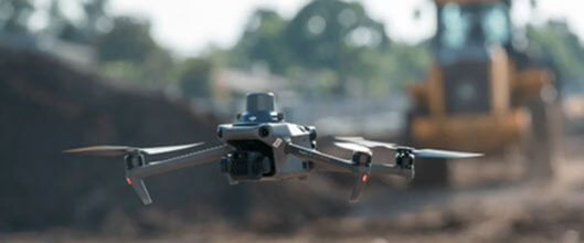
Survey-grade data, not consumer drone footage. Real-time kinematic positioning delivers centimeter-level accuracy. Point clouds, orthomosaics, and 3D models processed through DroneDeploy for as-built documentation.
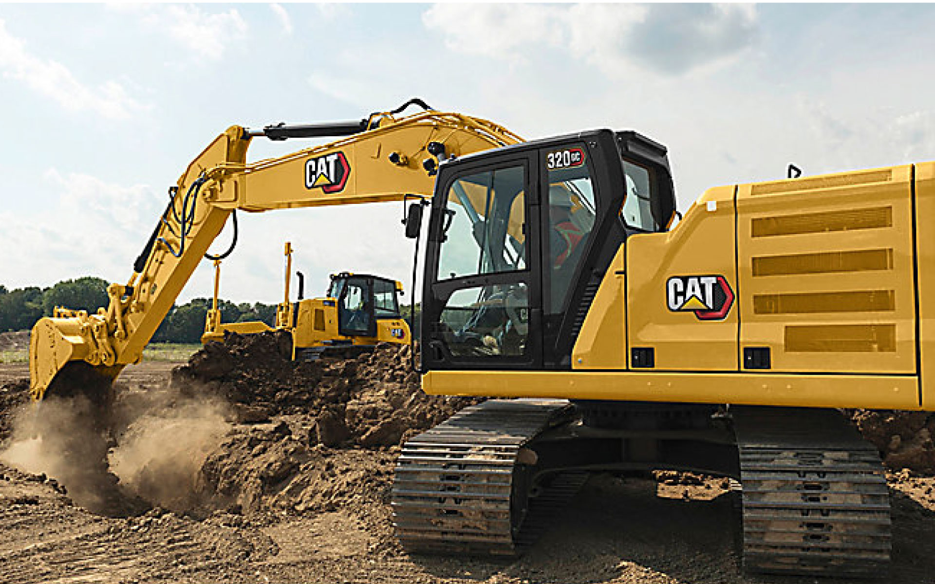
A 20-ton class medium hydraulic excavator designed for high efficiency, lower fuel consumption, and reduced maintenance. It features advanced technologies, including Cat Grade with 2D, Payload, and Auto Dig Boost.
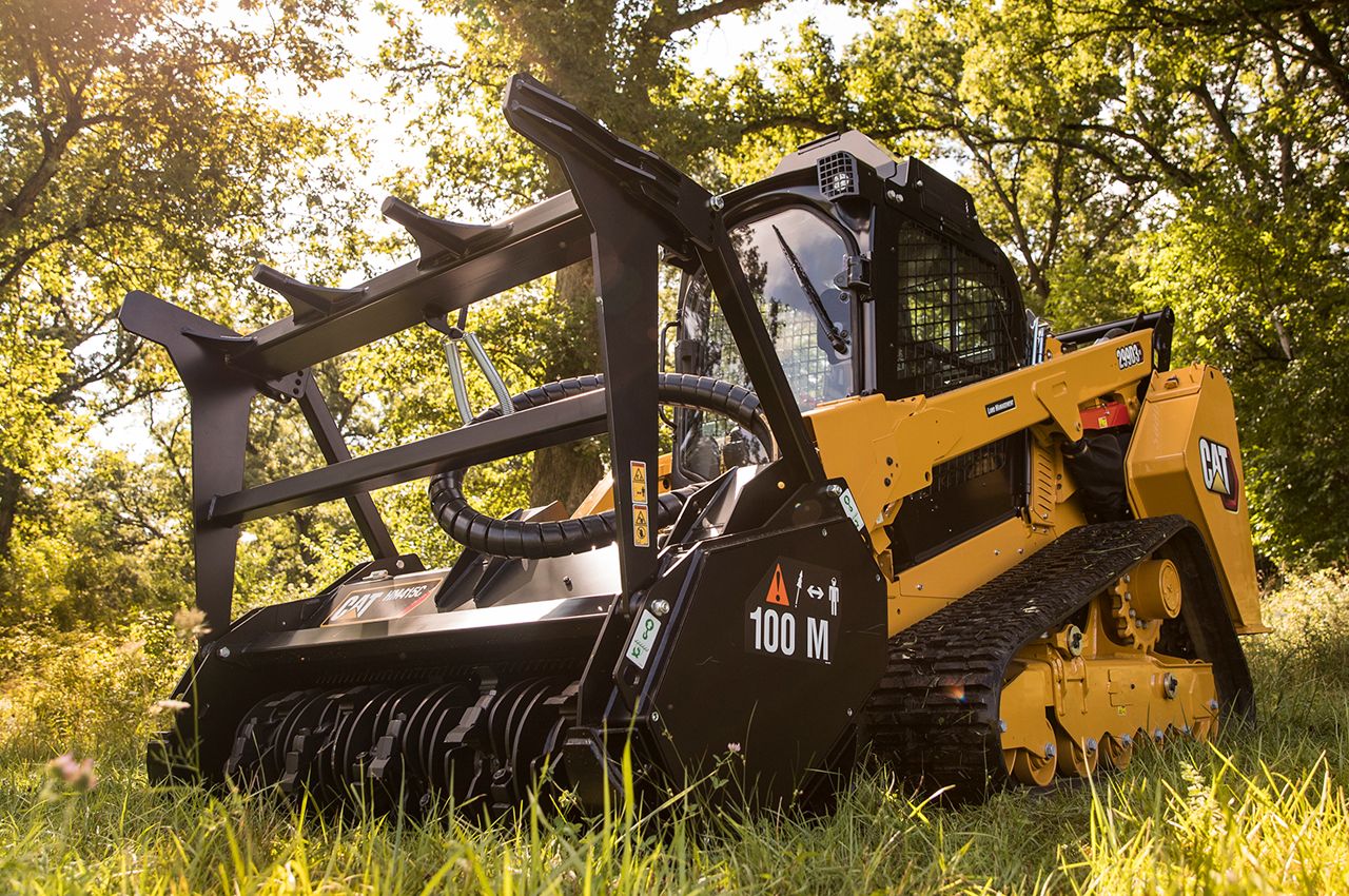
Carries the FAE mulcher/rock crusher attachment. Converts between forestry mulching, rock processing, and grading modes.
Watch the process from scan to shell.
See the rock before you bid.
"We let the data speak first." We're selectively offering complimentary RTK site scans to qualifying pool and estate projects in Austin and Hill Country. No obligation. You get a georeferenced 3D subgrade model of your site. We get to show you what we do. If you want to work together after that, we'll talk.
Georeferenced orthophoto, elevation model, and limestone shelf detection for your pool site. Delivered within 48 hours of site visit. Yours to keep regardless of whether we work together.
Book Your Site Scan