RECLAIM YOUR
HILL COUNTRY VIEW.
Your property is buried under cedar. Views are gone. Fire risk is climbing. You don't need a burn permit and a hauling contract — you need one pass that turns a thicket into a park. We scan before we clear. We prove what we move.
Get Site Prep QuoteWimberley · Lakeway · Spicewood
Your view is gone.
Your value is buried.
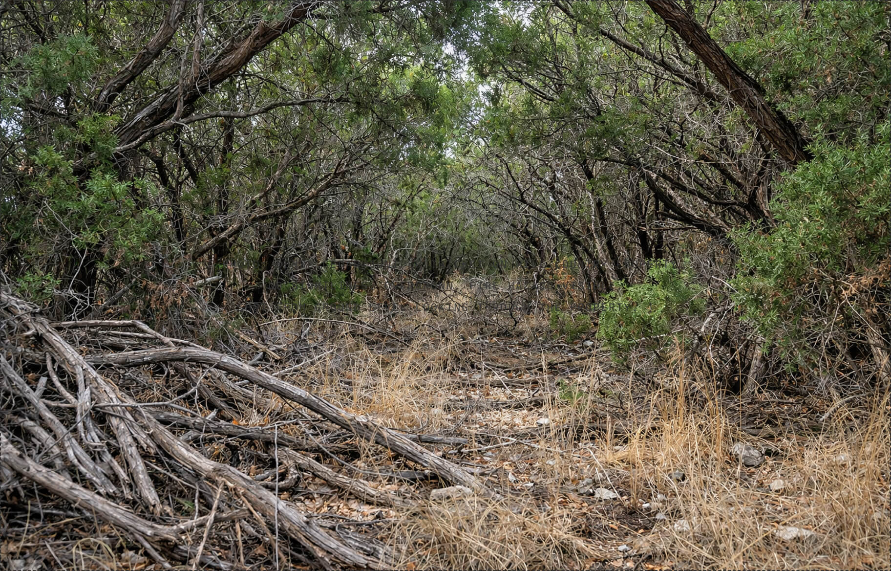
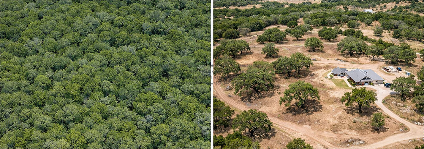
Ashe juniper doesn't stop. Left unchecked, it forms a dense canopy that blocks sightlines, chokes native species, and makes a $2M property look unmanaged. Every year you wait, the root system gets deeper and the removal gets harder.
Fire risk is
not hypothetical.
Hill Country wildfire seasons are getting longer. Cedar thickets carry fire faster than any other native vegetation. Without defensible space, you're one dry summer away from a conversation with your insurance company you don't want to have.
The last guy
left a mess.
Burn piles that sat for months. Topsoil stripped to bare rock. Ruts from equipment too heavy for the terrain. You trusted a contractor who cleared by volume, not by plan. You need someone who shows you exactly what gets cut and what stays — before they start.
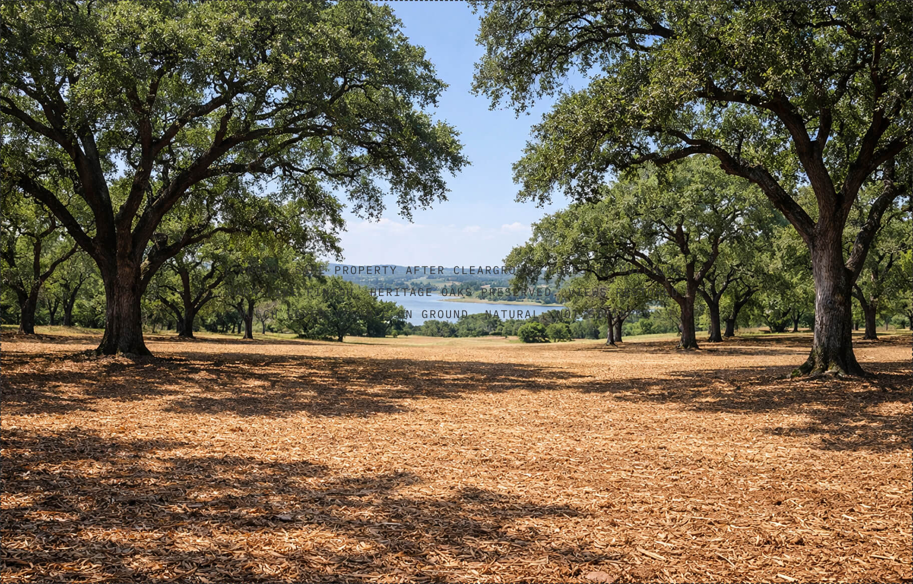
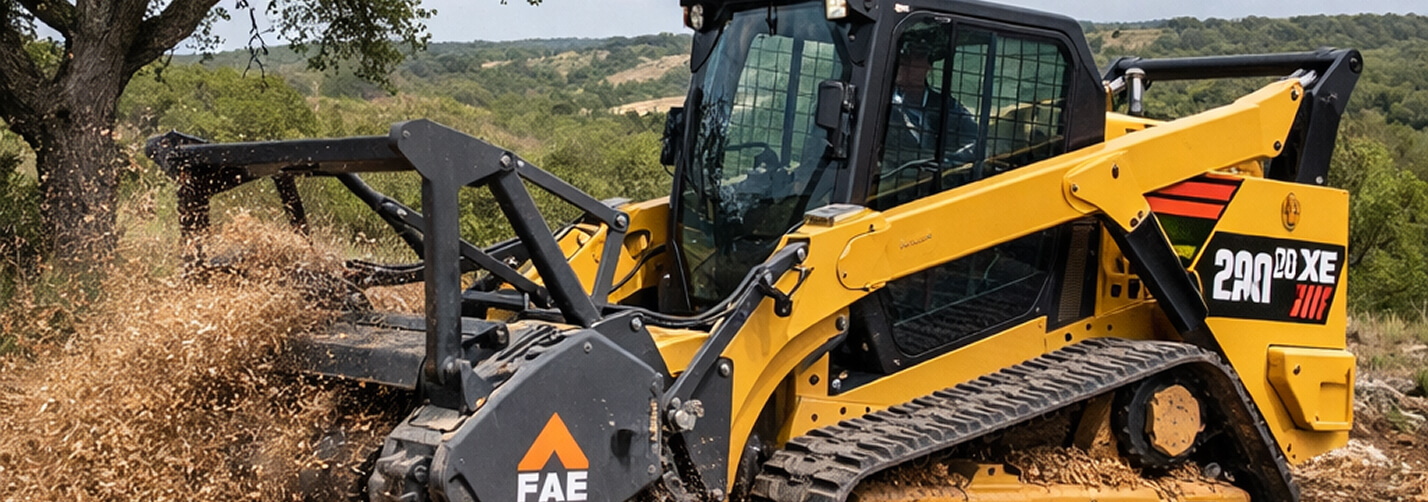
ONE MOBILIZATION.
FULL TRANSFORMATION.
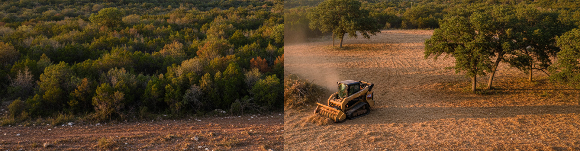
From cedar thicket to park-like finish — this is the sequence. One crew, one scan, one handoff. Nothing leaves the site that doesn't have to.
AT ANY PHASE OF YOUR CLEARING
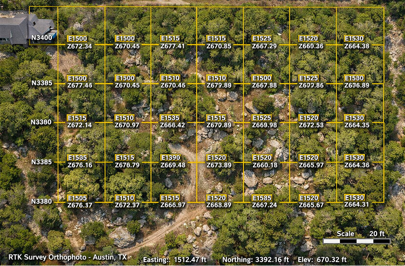
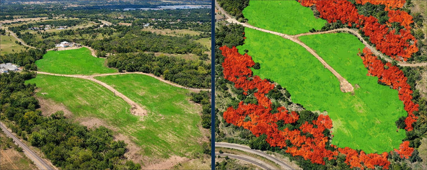
SEE EXACTLY WHAT CHANGED
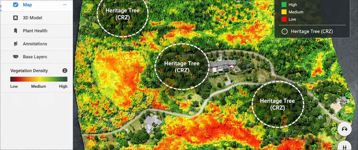
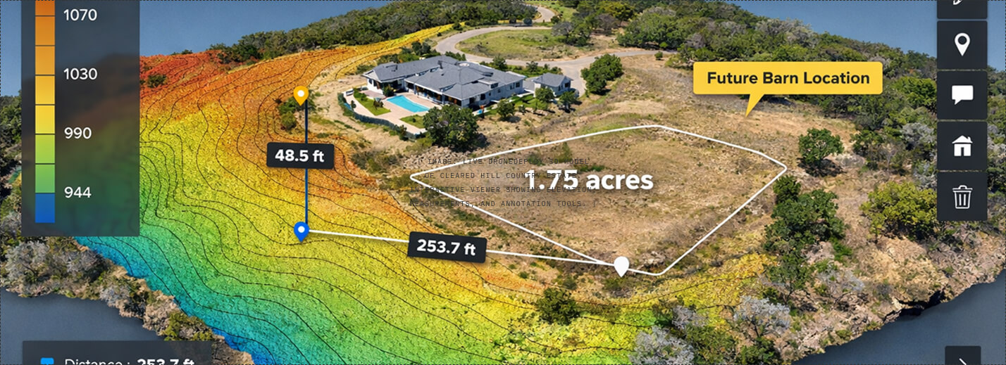
WE MAP YOUR LAND BEFORE WE TOUCH IT.
Most clearing crews show up and start cutting. We show up with a Mavic 3 Enterprise RTK drone that maps every tree, slope, and drainage line on your property to ±0.5cm accuracy. Heritage oaks get flagged. Densest brush zones get prioritized. You see the plan — and approve it — before a single cedar comes down.
CLEAR IT ONCE.
KEEP IT CLEAR.
Cedar grows back. Fire risk returns. One clearing job without a maintenance plan is a temporary fix. Lock in annual or biannual service and your property stays managed, your views stay open, and your insurance company stays happy.
- Perimeter defensible space maintenance
- Annual RTK progress scan
- Cedar/juniper regrowth removal
- Before/after documentation
- Priority scheduling
- Everything in Bronze
- Bi-annual clearing passes
- Invasive species monitoring
- Drainage path maintenance
- Digital twin updated each visit
- Wildfire mitigation documentation
- Everything in Silver
- Quarterly clearing + inspection
- Full property vegetation management
- Heritage tree health monitoring
- Quarterly digital twin updates
- Insurance documentation package
- Dedicated account manager
We scan your property, show you exactly where the densest brush is, then mulch it in place. You see the before and after in 3D. No burn permits. No hauling. Nothing leaves the site that doesn't have to.
— ClearGround · The Ground, Verified.
[ PLACEHOLDER: Replace with client testimonial after first estate clearing project ]
WE LET THE DATA
SPEAK FIRST.
We'll fly your property, map the vegetation density, and show you exactly what a clearing plan looks like — before you commit to anything. No sales pitch. Just data.
Free Site Risk Assessment · No Obligation · 48-Hour Mobilization