


DRONE SITE DATA FOR CIVIL ENGINEERS
IN AUSTIN, TX.
Your as-built data doesn't drop into CAD, and your client deadline isn't moving. You get georeferenced point clouds, orthomosaics and cut/fill reports, typically 2–3 business days after the flight.
Clear Ground delivers drone topo, point clouds, orthomosaics and cut/fill reports to civil engineering firms in Austin and Central Texas. A standalone scan runs $500–$1,500 per scan, with reports typically 2–3 business days after the flight. Files import into AutoCAD and Civil 3D. This is not a boundary survey.
Request a Scan QuoteCedar Park · Georgetown · San Marcos
Waiting on existing-conditions data slows design.
Your design schedule doesn't pause while you wait on field data. You end up assuming existing conditions that don't get checked until it is expensive to change the plan.
As-built data that doesn't integrate.
You receive a PDF and a field sketch. Someone on your team has to rebuild it in CAD. Every hand-off adds a chance for error. You need georeferenced data in a format your CAD software opens.
Disputed quantities. Client disputes.
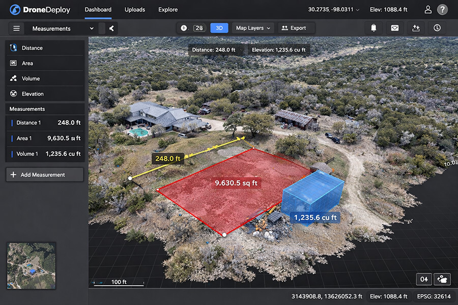
When volumetric estimates don't match final bills, you're the one explaining the discrepancy to your client. You need a verifiable system of record — one that measures what was actually moved, not what was guessed at before mobilization.
FROM FIELD REQUEST
TO CAD FILES.
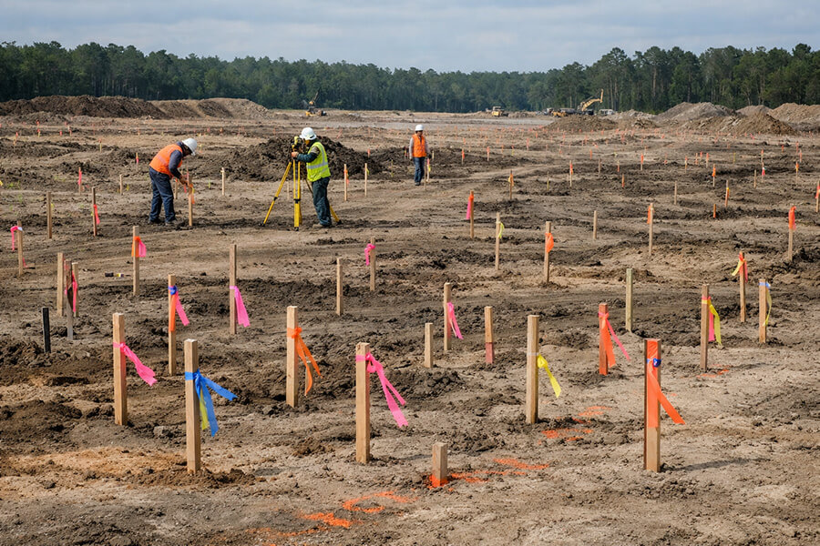
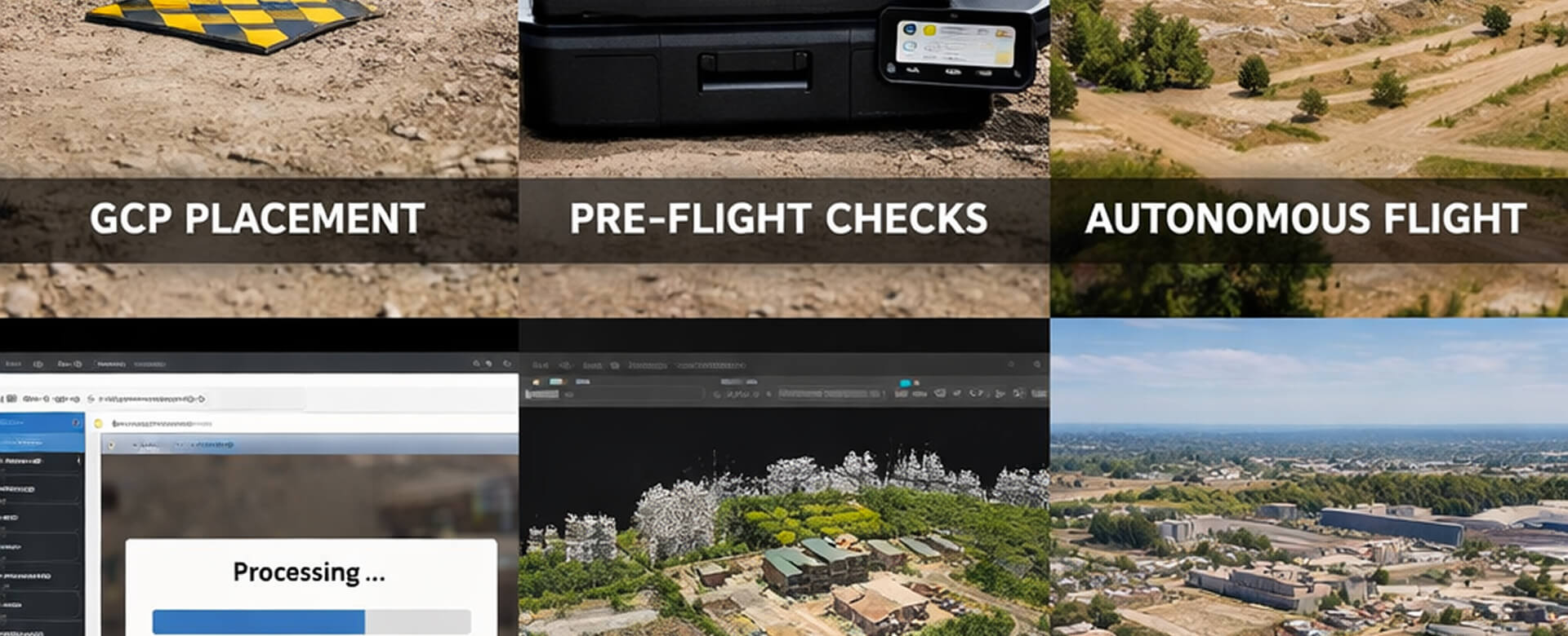
RTK drone capture and processing. One call, one flight, one deliverable in your file format, typically 2–3 business days after the flight.
AT ANY PHASE OF YOUR PROJECT
SEE THE SITE AS IT IS
SURFACE TOPO. BEFORE DESIGN.
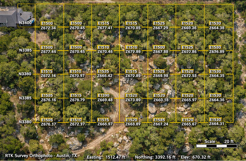
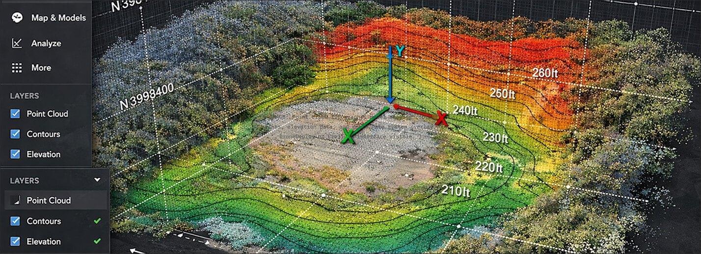
Your design starts with data, not assumptions. We deploy a Mavic 3 Enterprise RTK drone that captures the site surface: topo, vegetation, visible utility features and drainage patterns. RTK-corrected drone photogrammetry, checked against ground points on site. Delivered as a georeferenced point cloud your CAD software opens. A drone models the ground surface. Rock, footings and buried lines below the surface are found with test holes, probing, 811 locates and GPR where needed.
SPECS, NOT PROMISES.
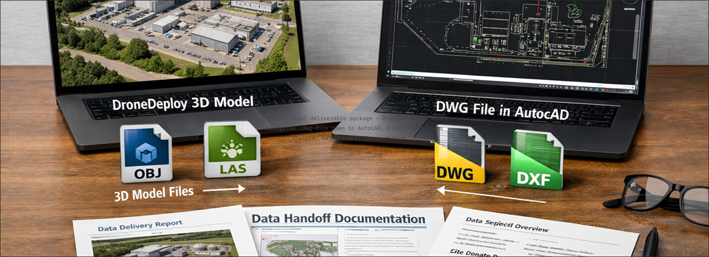
Every Clear Ground project produces structured, georeferenced data deliverables. These are the datasets your team brings into active design and construction workflows.
Formats: .las · .laz · .tif · .obj
Platform: Pix4D web viewer
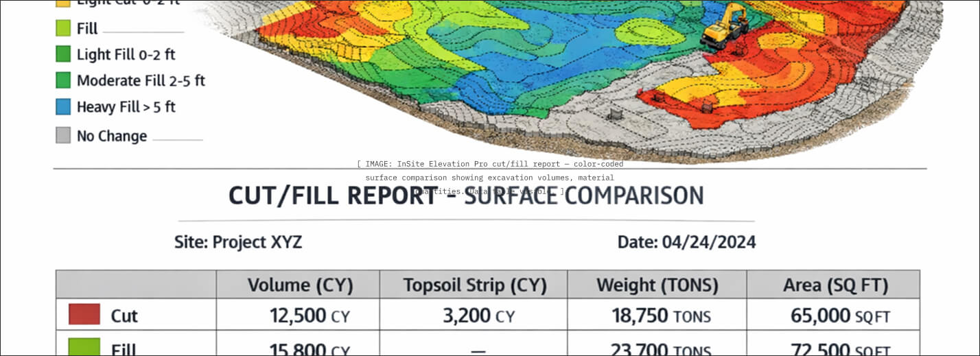
Formats: .pdf · .csv · .xml
Platform: InSite Elevation Pro
Formats: .dwg · .las
Platform: AutoCAD · Civil 3D
Our drone scans measure surfaces, quantities and grades. They are not a boundary survey or a sealed survey by a licensed surveyor, and a drone cannot see below the ground surface. Registered on Avetta and ISNetworld. Certificate of insurance and additional-insured endorsement provided before work starts.
Data services pricing
| Service | Unit | Range | Typical timeline |
|---|---|---|---|
| Standalone drone topo and volume report: orthomosaic, point cloud, contours, cut/fill | per scan | $500–$1,500 | 2–3 business days after the flight |
| Larger sites and repeat scans | by site | Quoted after we see the acreage and the number of flights. Written quote within 48 hours of the site walk. | |
Prices reviewed: September 2026. Ranges for Austin and Central Texas; your site walk sets the final number.
Georeferenced photogrammetry delivered as topo, point cloud and volumes, in files your CAD software opens. We're the field data arm you don't have to hire.
Frequently asked questions
How much does a standalone drone scan cost?
$500–$1,500 per scan for a topo and volume report. Larger sites and repeat scans are quoted after we see the site.
How fast do I get the data?
Typically 2–3 business days after the flight. That covers processing and the report, not scheduling. We answer the same business day.
How accurate is the data?
RTK-corrected drone photogrammetry, checked against ground points on site. Our drone scans measure surfaces, quantities and grades. They are not a boundary survey or a sealed survey by a licensed surveyor, and a drone cannot see below the ground surface.
Does this replace my surveyor?
No. It supports your design with surface data. Boundaries, sealed topo and buried utility locations come from a licensed surveyor and 811 locates.
Which file formats and coordinates do you deliver?
Point cloud (.las, .laz), GeoTIFF, .dwg contours and surfaces, and cut/fill reports. Coordinates are NAD83 / Texas State Plane, Central Zone.
Is the iPhone scan survey-grade?
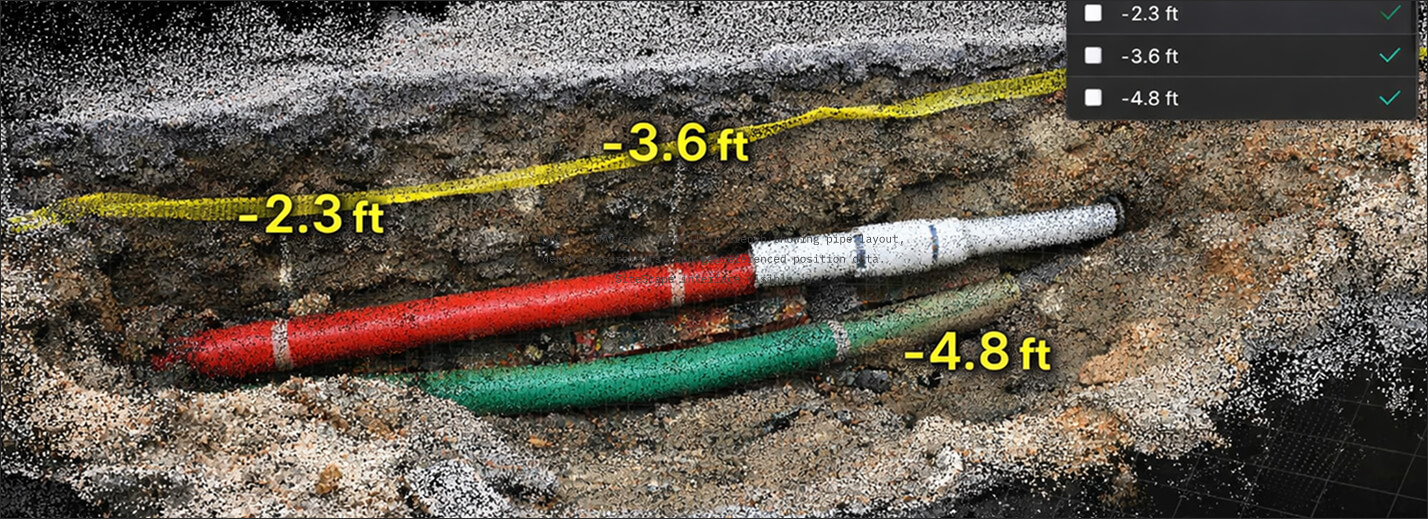
No. The SiteScape iPhone scan is a quick visual record of open trenches and footings before backfill. Use your surveyor for as-built locations.
WE LET THE DATA SPEAK FIRST.
Request a sample dataset. We'll show you exactly what a Clear Ground deliverable looks like — point cloud, volumetric report and CAD export, before you commit to anything. No sales pitch. Just data.