Texas Will Reimburse You Up to $2,000 an Acre to Clear Your Land.
The Texas A&M Forest Service is reimbursing Central Texas landowners up to $2,000 per acre to reduce hazardous brush with a forestry mulcher — the top reimbursement tier, and exactly the work we do. It's a reimbursement, not cash up front, and the application window closes July 14. We'll map your property, file before the deadline, and clear it if you're awarded.
How the Grant Actually Works
It's a reimbursement, not a check in the mail and not a loan. You apply and map your property online before July 14. If your application is awarded, you hire an independent contractor — that's us — to do the fuel-reduction work, and the state reimburses you up to the per-acre rate. The heavy-equipment tier is forestry mulching, which is exactly our core service and the highest reimbursement rate available.
You Point at the Cedar. We Map It, File It, Clear It.
The grant exists — the online application is what stops most people. So we handle that part. You don't fill out a government form or learn a mapping tool. You just show us the land.
We Map Your Property
Our Mavic 3 Enterprise RTK drone surveys your land to ±0.5cm and produces the property map the application requires — the same scan that documents your before/after in 3D.

We File Before July 14
We prepare and submit the online application and property map ahead of the deadline, so a missed form or a slow government portal isn't what costs you the reimbursement.
We Clear It — If You're Awarded
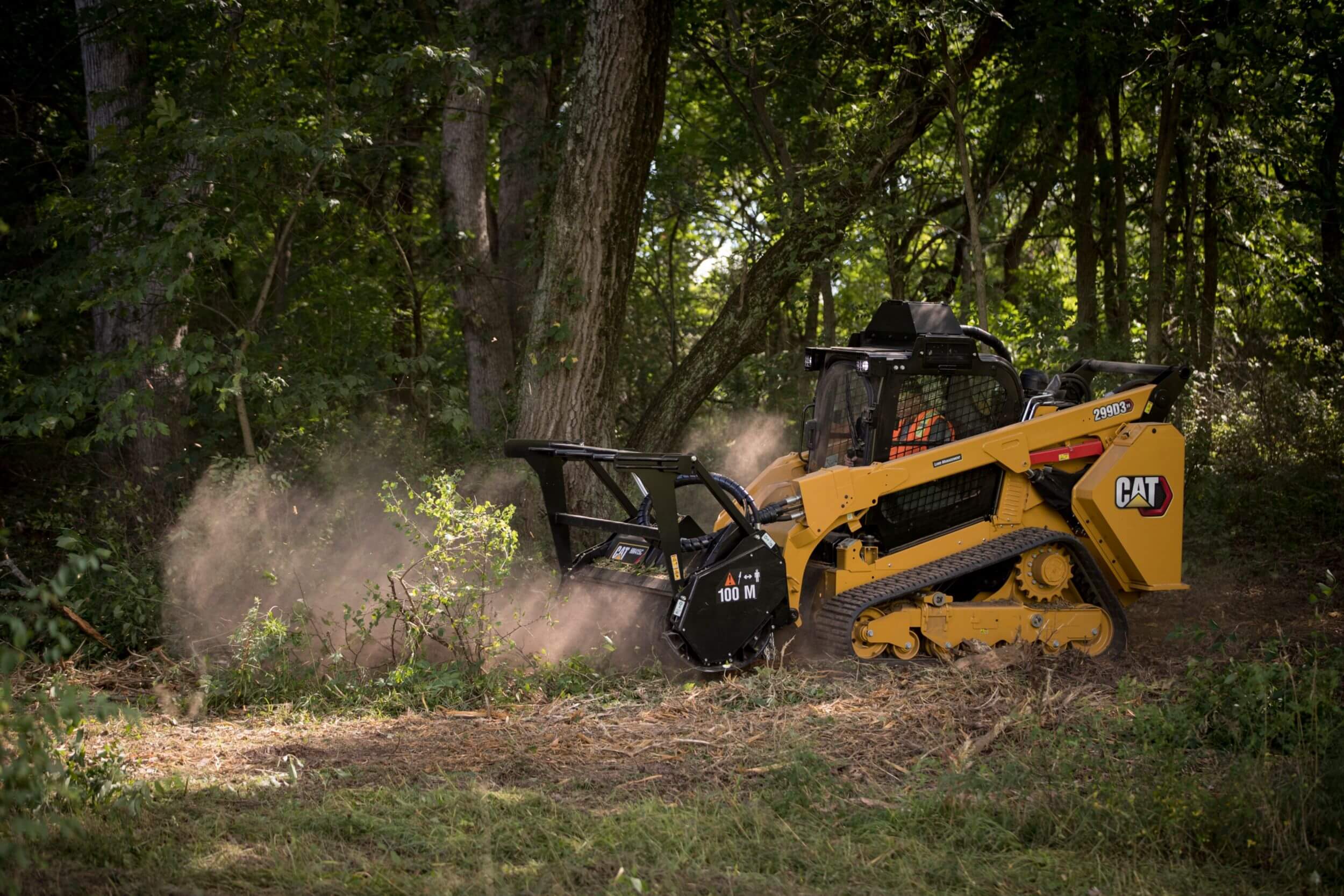
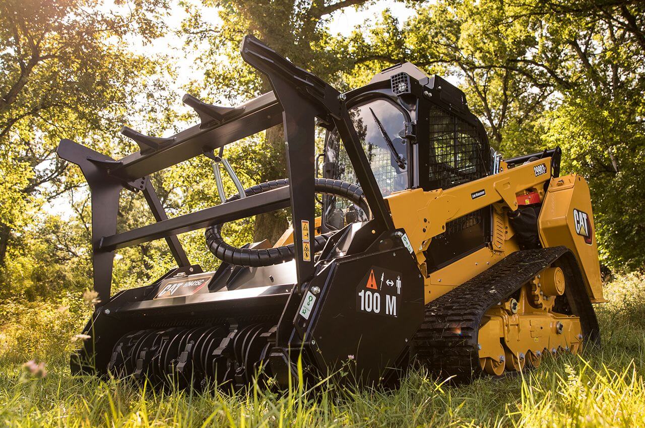
If your application is approved, our CAT 299D3 XE with an FAE mulcher head clears the brush in place. No burn piles, no haul-off. The state reimburses you up to the per-acre rate.
What the Work Looks Like.
Dense Ashe juniper choking a Hill Country fence line, mulched in place to a clean, park-like finish — heritage oaks preserved, mulch left on the soil, zero burning, zero haul-off. Exactly the heavy-equipment fuel reduction the grant reimburses.

Cedar overgrown to the fence line — fuel load stacked, view and pasture lost.

Cleared in place. Oaks kept, mulch on the soil, defensible space opened up.
Illustrative of typical Hill Country cedar fuel reduction. Every project ships a georeferenced before/after 3D digital twin of your own property.
The Grant Pays for the Clearing. We Prove It Was Done.
Most crews will run a mulcher through your cedar and leave. We treat fuel reduction as a documented, verified service — which matters when the work ties back to a state grant, your insurer, and your fire marshal.
Typical Crew
- You're on your own for the application and map
- Show up, cut brush, leave
- Burn piles & haul-off tear up your roads
- Before/after phone photos at best
- Nothing your insurer or fire marshal can use
ClearGround
- We map your property & file before July 14
- RTK drone maps the fuel load before we cut
- In-place mulching — zero burn, zero haul-off
- Georeferenced 3D twin of every foot cleared
- Insurance-ready proof — send a link, not photos

Is Your Land in a Covered County?
The program covers private landowners, HOAs, nonprofits, and local government across 39 Central Texas counties. Pick your county and acreage for a rough idea of what's on the table. This is an estimate of the program's maximums — not a guarantee of any award.
Estimate only. Reimbursement is up to $2,000/acre at the heavy-equipment (forestry-mulcher) tier, capped at $20,000 per landowner, and is paid only if your application is awarded. The full list of 39 covered counties is maintained by the Texas A&M Forest Service — confirm your county on the official program page. Book a site scan and we'll confirm eligibility for your specific property.
Book a Free Site Scan Before July 14.
One scan does three jobs: it builds the property map your application needs, gives you an exact picture of the brush to clear, and locks in your spot before the deadline. No obligation, no pressure.
- We map your property with RTK drone survey
- We prepare and file your grant application
- We clear the land if you're awarded — reimbursed up to $2,000/acre
- Serving the Hill Country: Dripping Springs, Wimberley, Lakeway, Spicewood, Georgetown, Marble Falls & more