Overgrown acreage, choked fence lines, view-blocking brush. One machine pass handles all of it.
Field & Brush Clearing in Austin & the Texas Hill Country
Field and brush clearing mulches overgrown fields, fence lines and brush in place with one machine pass. It suits ranch, estate and acreage owners in Austin and the Texas Hill Country. Light brush runs $2,000–$2,800 per acre, up to $5,200 per acre for dense stands. Most jobs take 0.5–5 days and include the site walk and cleanup.
Field and brush clearing is the general-purpose capability within the forestry mulching service — applicable anywhere vegetation has overgrown what it should not occupy. The end state is an open, manageable surface with all cleared material returned to the soil as protective mulch. No fire, no haul-off of cleared vegetation, and no bare, erosion-prone dirt.
The Capability
What the Machine Does
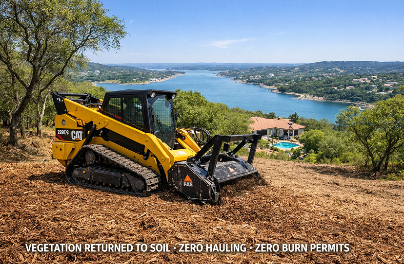
The CAT 299D3 XE fitted with an FAE forestry mulching head processes vegetation in a single pass — cutting at the base, feeding through the drum, and returning material as chip-level mulch in one continuous motion. Small trees, dense brush stands, mixed undergrowth, dead material and thatch are handled by the same head without changing equipment.
The result: the surface is clear. The soil profile is intact and covered by a 1–3" mulch layer. Nothing is trucked off. The cleared acreage is documented with before and after photos.
What it does not do: Field and brush clearing is not land clearing. It does not grub roots to bare dirt, does not produce a construction-ready grade, and does not prepare a surface for concrete or structural foundations. If bare-dirt preparation is the goal, that is land clearing, which is priced separately.
The Outcome
What the Land Looks Like After
A well-executed brush clearing leaves the land looking intentional — open ground, manageable grass, preserved specimen trees standing cleanly without crowding brush at their base. The mulch layer blends into the ground within one growing season. The mulch layer covers the soil and slows moisture loss, which helps grass establish.
Views open. Fence lines become visible and inspectable. Roads and access paths regain their width. Properties that looked abandoned look managed. Photos before and after record the change.
What it preserves: Every specimen tree, live oak, pecan, and native tree marked in the pre-clearing plan stays exactly where it is. Clearing zones, preservation zones, and clearing boundaries are set before the machine rolls — and confirmed after by a post-clearing walk.
Terrain Types & Clearing Rate
Type 01
Light Brush & Thatch
Young growth, mixed undergrowth under 4" diameter, annual thatch accumulation. Common in maintained properties with recent history.
Rate: 2–4 acres / day
Type 02
Moderate Cedar & Brush
Mixed cedar stands 4–8" diameter, established juniper, medium-density invasive brush. Most Hill Country properties fall here.
Rate: 1–2 acres / day
Type 03
Dense Mature Cedar
Heavy cedar monoculture, trunk diameters 8–12"+, no-daylight-through-canopy density. Unmaintained land for 10+ years.
Rate: 0.5–1 acre / day
Type 04
Mixed Rocky Terrain
Cedar or brush on Hill Country limestone with significant rock exposure. Terrain slows machine speed and increases wear per acre.
Rate: 0.5–1.5 acres / day
What Gets Cleared
Six Field & Brush Clearing Scenarios
Field and brush clearing covers a wide range of overgrowth situations — from a homeowner wanting their view back to a rancher reclaiming acres of cedar. Every scenario runs on the same machine, the same photo record and the same no-burn, mulch-in-place method.
Most Common
Cedar Thicket & Monoculture Clearing
Dense Ashe juniper stands that have crowded out grass and native plants. One machine pass opens the land, grinding the cedar in place. Ashe juniper does not resprout once cut below the lowest green limb. See the brush and cedar clearing page.
Duration: 1–5 days · Equipment: CAT 299D3 XE + FAE Head
$4,000–$5,200
/ acre
Price reflects density. The site walk confirms it before the quote.
What drives the price up
Mature cedar with trunk diameters above 8" processes slower than young growth. No-daylight-through-canopy density limits machine speed. Rocky terrain underneath increases wear and slows the pass. Properties unmaintained for 10+ years are consistently at the high end of the range.
General Purpose
Mixed Brush & Undergrowth Clearing
A mix of species: mesquite, agarita, prickly pear, huisache, shin oak and understory brush in untended fields and along property edges. The FAE head handles the mix in one pass. Mesquite, huisache and shin oak resprout from the roots; see root extraction.
Duration: 0.5–3 days · Equipment: CAT 299D3 XE + FAE Head
$2,000–$2,800 light, $2,800–$3,900 moderate
/ acre
Range reflects density and terrain.
What drives the price up
Mixed species stands with varying trunk sizes process less predictably than uniform growth. Prickly pear at high density is slow going. Properties with significant slope change add positioning time. Preservation requirements in mixed stands require more careful operator judgment and slower speeds near selected trees.
Estate / Residential
View Corridor & Selective Opening
Precision selective clearing that removes specific brush and cedar to open views — to a ridgeline, a valley, a water feature, or the sunset — without wholesale clearing of the property. We mark the target view axis on the ground before clearing, the machine works within the marked corridor, and a post-clearing walk confirms the result.
Duration: 0.5–2 days · Equipment: CAT 299D3 XE + FAE Head
$2,000–$2,800 light, $2,800–$3,900 moderate
/ acre
Scoped per corridor, priced by density. Minimum half-day mobilization.
What drives the price up
Selective clearing — where specific trees within a dense stand are preserved — takes significantly more operator attention and slower pass speeds than open clearing. Narrow view corridors with precise boundary requirements need more positioning time. Properties where the desired view axis requires working around existing structures or mature specimen trees add complexity.
Pre-Development
Lot Clearing for Development Access
Clearing an undeveloped lot or acreage to establish construction access, allow survey work, or prepare for a land clearing phase. Brush clearing at this stage removes the overgrowth layer so a site can be properly assessed and staked before heavy equipment moves in. Not a substitute for land clearing. A precursor to it.
Duration: 0.5–2 days · Equipment: CAT 299D3 XE + FAE Head
$2,000–$2,800 light, $2,800–$3,900 moderate
/ acre
Often paired with land clearing as phase one.
What drives the price up
Lots with significant cedar or mature brush on top of known limestone require more careful pass planning if a later land clearing phase needs to access specific areas. Lots adjacent to heritage trees or CRZ zones require more precise boundary management. Properties where construction timeline is compressed and mobilization must coordinate with other crews add scheduling complexity.
Large-Scale
Overgrown Field & Pasture Clearing
Fields that were once open — agricultural, recreational, or simply natural grass — that have been progressively invaded by cedar, Mesquite, and brush over years of non-management. The clearing recovers what was there before: open ground, native grass potential, and the light that invasive species blocked. Larger acreage, systematic zone approach, phased clearing available.
Duration: 2–10+ days · Equipment: CAT 299D3 XE + FAE Head
$2,000–$2,800 light, $2,800–$3,900 moderate
/ acre
Large tracts are quoted at the site walk.
What drives the price up
Mixed-age stands where young growth and mature growth are intermixed require variable pass speeds. Fields with drainage features — wet weather creeks, seasonal ponds, low areas — require machine repositioning around sensitive areas. Properties with prior clearing history that was partial or abandoned may have irregular density patterns that reduce the efficiency of zone-based clearing.
Recurring
Annual & Biennial Maintenance Clearing
Mesquite and other resprouters come back, and seedlings fill in cleared ground. Annual or biennial maintenance clearing catches regrowth before it becomes a restoration project again. Visits are scoped from the post-clearing photos, so the work targets where new growth has occurred, not the whole property.
Duration: 0.5–2 days · Equipment: CAT 299D3 XE + FAE Head
$2,000–$3,500
/ visit
Available to clients with completed initial clearing.
What drives the price up
Properties with heavy cedar seed sources nearby see faster seedling regrowth. Regular maintenance costs less per visit than recovery clearing after years of unchecked regrowth.
Species Reference
Ashe Juniper (Cedar)Honey MesquiteHuisacheAgaritaPrickly PearTasajilloGreenbriarShin Oak (selective)Dead Standing MaterialAnnual Thatch / Dry GrassLive Oak — PreservedPecan — PreservedNative Grasses — PreservedHeritage Trees — Protected
How It's Done
Mulch-In-Place vs. Every Alternative
There are three ways to clear field and brush. Two of them create additional problems. The comparison below is why we use the FAE mulching head for field and brush work.
Traditional Methods
Clear-and-Haul / Clear-and-Burn
×
Multiple equipment passes — felling crew, skid steer for piling, haul trucks for removal. Each pass costs money and time.
×
Burning is restricted — TCEQ outdoor-burning rules and county burn bans often close the window in dry months.
×
Hauling costs add up fast — tipping fees and trucking add cost, and trucks compact soil and wear down roads.
×
Soil profile disrupted — bare dirt after clearing erodes immediately, loses organic material, and requires remediation before native grass establishes.
×
Little documentation — often no measurement of what was cleared and no record for insurance or future reference.
×
Ember risk during burns — burns in dry conditions can escape containment, and cedar burns hot.
Clear Ground — Mulch-In-Place
One Pass. Mulch In Place. Documented.
✓
Single machine pass — the FAE head cuts, chips, and returns in one continuous motion. One mobilization, one pass, one done.
✓
No burning — no burn-ban delays and no smoke. Clearing proceeds on any day conditions allow machine operation.
✓
No haul-off of cleared vegetation — material stays on the property as mulch, so there are no tipping fees for it.
✓
Soil profile intact — the mulch layer covers the soil and slows erosion and moisture loss.
✓
Photo-documented acreage. Before and after photos record what was cleared. An optional drone scan adds a 3D surface model of the site.
✓
Nothing to escape containment — nothing is burned, so there is no burn to get away from you.
See what changed at every phase
At Any Phase of Your Field & Brush Clearing: What You Get to Keep
Phase 01
Pre-Clearing Site Walk
The Plan Comes From the Ground and the Map.
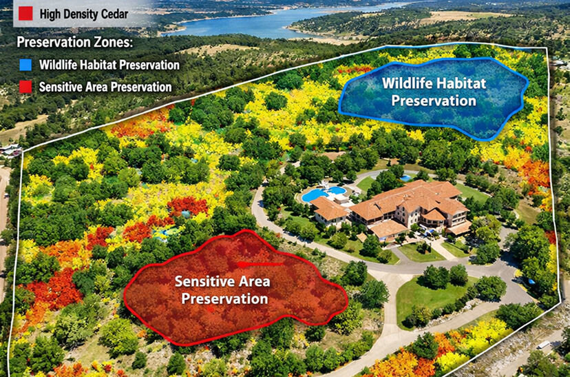
Before a machine is scheduled we walk the property with you. Vegetation type and density are noted zone by zone, so the heavy clearing is separated from the light work. Specimen trees and drainage features are identified and documented.
The clearing plan is built from the walk. Every preservation zone, clearing boundary and staging area is defined before the machine rolls. You approve the plan. Then we move.
Site Walk With YouOptional Drone ScanDensity Zones IdentifiedSpecimen Trees FlaggedClearing Plan Built from the Walk
Phase 02
Systematic Clearing Execution
Dense Zones First. Nothing Left Guessed.
The CAT 299D3 XE with FAE mulching head works the property in the sequence defined by the clearing plan — highest-density zones addressed first, selective preservation zones worked carefully, boundaries marked before the job starts.
Cedar, Mesquite, and mixed brush are ground in place. The material is returned to the soil at chip level. Nothing is burned and nothing is trucked off. No secondary operations required. The field or brush area transitions to open ground in a single equipment pass, leaving the mulch layer in place to protect the soil and support native grass recovery.
CAT 299D3 XEFAE Mulching HeadDensity-First SequenceBoundaries Marked Before StartMulch Stays On SiteNo Burning
Phase 03
Mid-Job Progress Verification
Progress Tracked. Boundaries Confirmed.
On multi-day projects, mid-job photos show what has been cleared and what remains. Dense zone progress is confirmed against the clearing plan. Preservation boundaries are verified — no creep into flagged specimen trees or property-line buffer zones. If a terrain feature changes the optimal clearing sequence, it's documented and adjusted before proceeding.
You don't need to drive to the property to know where the crew is. The photos show what changed since the last update.
Mid-Job PhotosCleared Zone Progress DeltaPreservation Zone ConfirmationProgress Imagery Shared
Phase 04
Completion & Acreage Verification
Every Acre on the Invoice Is an Acre Walked and Photographed.
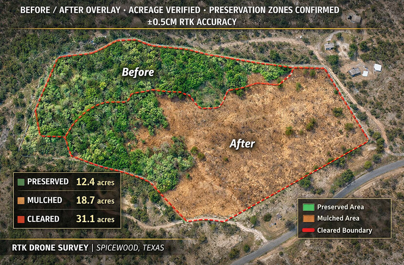
At the end we walk the completed clearing with you and compare it to the before photos, zone by zone. The preserved areas are confirmed untouched.
If any element of the clearing plan wasn't completed to specification, it's identified before the machine demobilizes and addressed before the job is closed. The final documentation only goes out when the work matches the plan.
Before / After OverlayCleared Acreage CheckPreservation Zone ConfirmationPhoto Record
Phase 05
Deliverable
Your Property. On Record. Before and After.
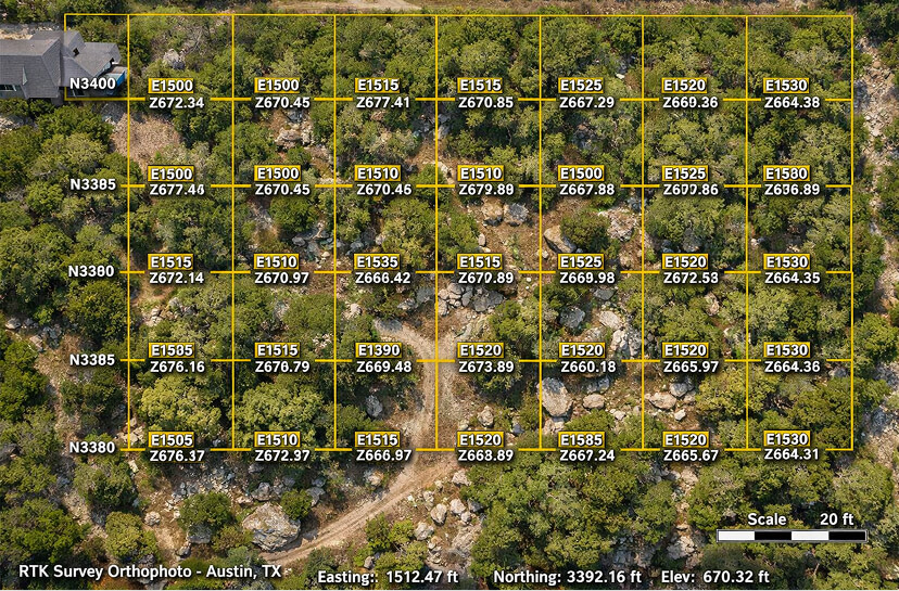
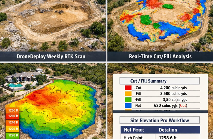
You get before-and-after photos of the property. Share them with a landscape architect, a real estate agent, a wildlife biologist or a land manager, or keep them for your records. An optional drone scan adds a 3D surface model of the site, $500–$1,500 per scan.
The photos also serve as the baseline for annual maintenance clearing. Future visits compare against them to target where regrowth has occurred. They are a visual record of the work, not a boundary survey.
Before / After PhotosBefore / After ArchiveOptional Drone ScanAnnual Maintenance Baseline
Start with a site walk.
Book a Site Walk and Get a Written Quote.
We walk the property with you, mark what stays and what goes, and price it by vegetation density. Written quote within 48 hours of the site walk. No obligation to proceed.
Cedar and mixed brush mulched in place, with the ground left open.
Before / After — Cedar & Mixed Brush
Single-Pass Clearing
Before Clearing
Post-Clearing Result
CAT 299D3 XE — FAE Head
Transparent Pricing
Field & Brush Clearing Pricing — Central Texas
Price is driven by vegetation density and terrain. The ranges below are for forestry mulching in the Austin and Hill Country market. The site walk tells us where your project falls before we quote a number.
$2,000–$2,800 light, $2,800–$3,900 moderate / acre; quoted at the site walk
Annual Maintenance Clearing
0.5–2 days
Per property
$2,000–$3,500 / visit
Pricing includes operator, fuel and machine time. Highlighted rows are the most common scenarios. Properties with significant limestone exposure may need rock milling, priced separately. Bare-dirt, grubbed and hauled clearing is land clearing, also priced separately. See pricing and the land clearing calculator. All prices assume mulch in place, so there are no tipping fees for cleared vegetation.
Prices reviewed: September 2026. Ranges for Austin and Central Texas; your site walk sets the final number.
Site Walk and Written Quote
Before and After Photos
Optional: drone scan and 3D surface model of the site, $500–$1,500 per scan.
Operator, Fuel and Machine Time
No Burning
Mulch Left On Site
Recurring Maintenance
Vegetation Management Subscription Plans
A cleared property that isn't maintained reverts. Resprouters like mesquite come back from the roots, and cedar seedlings fill in cleared ground. An annual clearing agreement keeps cleared areas managed on a set schedule and targets where regrowth has occurred, not the whole property again.
Tier 01
Buffer
Perimeter & fence line annual clearing
$2,000 / year
Billed Annually
CoverageUp to 1-acre perimeter
Frequency1× Annual
ScopeFence lines + boundary
ScanAnnual comparison
Tier 02
Protection
Selective clearing + regrowth management
$4,800 / year
Billed Annually
CoverageSet at the site walk
Frequency2× Annual (Spring + Fall)
ScopeRegrowth zones + fence lines
RecordSeasonal photo comparison
Tier 03
Estate
Full property + quarterly maintenance
$12,000 / year
Billed Quarterly
CoverageSet at the site walk
Frequency4× Annual (Quarterly)
ScopeFull property program
RecordQuarterly photo record
Maintenance agreements are available to clients who complete an initial clearing project with Clear Ground. Visits are compared against your post-clearing photos, so the work targets where regrowth has occurred, not the whole property again. Single visits run $2,000–$3,500 per visit.
Who This Is For
Field & Brush Clearing Clients
Field and brush clearing is the most broadly applicable service in the forestry mulching suite. The primary clients are estate and property owners — but the service reaches into every property type where overgrowth has exceeded what looks intentional or what's manageable.
Primary Client
Hill Country Estate & Ranchette Owners
Larger properties in Blanco, Kendall, Gillespie, Llano and Burnet counties where cedar and brush have taken over what was once open land. The goal is open views, working pasture and a manageable property, without burn piles or dump trucks.
Typical scenarios
Cedar has closed in on a view that was open at purchase
Fence lines are invisible under brush and structurally compromised
Property looks abandoned from the road or from the air
Brush clearing quotes in hand but no one has explained what they'll actually do
Smaller properties — 2 to 20 acres — where overgrowth has made a house feel enclosed, a lot feel unusable, or a rural property feel like a maintenance burden rather than an asset. Field and brush clearing at this scale usually takes a few days on site.
Typical scenarios
Cedar has grown up to and around the house since purchase
Back acreage is completely inaccessible under brush
Property line is hard to find because of overgrowth
Previous owner never maintained — new owner is starting from scratch
Undeveloped lots and parcels where brush clearing is the precursor to land clearing, survey work or site planning. Field and brush clearing opens the land for assessment — establishing sight lines for survey equipment, creating machine access for heavier earthwork, and giving the first clear aerial view of the property.
Typical scenarios
Overgrown lot where survey work can't proceed without clearing
Parcel purchased at land auction with unknown vegetation condition
Site work has to start before a survey or permit submittal can be finished
A crew can show up and cut. What matters is what happens before the machine rolls, during the clearing and after the job, and the documentation of all three.
01
A Quote Built on a Site Walk.
The price for your project comes from what we see on the ground. Vegetation density, terrain and preservation requirements are noted before a number is quoted.
Priced by Density
02
Acreage Documented Before and After
Before and after photos show what changed, so you can see the cleared acreage before the invoice is written.
Before and After
03
Single Pass. No Extra Operations.
The FAE mulching head cuts, chips, and returns in one continuous motion. No felling crew, no haul trucks, no burning, no secondary operations. The clearing is complete when the machine finishes its pass — not after three additional steps that each add cost and delay.
Mulch In Place
04
Specimen Trees Preserved and Confirmed
Every tree you want to keep is marked in the pre-clearing plan and confirmed untouched in the after photos. Live oaks, pecans and native trees you designate for preservation are documented before the machine starts and checked after it finishes.
Preservation Documented
05
Mulch Layer Protects the Soil
The chip-level mulch left by the FAE head covers the ground, slows moisture loss and returns organic matter to the soil surface.
Soil Health Preserved
06
Before & After Photo Record
Your before and after photos are yours to share. Use them to show a real estate agent, a landscape architect, a land manager or a buyer what was done and when.
Shareable Record
07
Maintenance Clearing Targets Regrowth
Annual maintenance visits use your post-clearing photos to find where regrowth has occurred. The clearing targets those zones, not the whole property, so visits are shorter.
Targeted Maintenance
08
Insured and Registered
$2,000,000 per occurrence / $5,000,000 aggregate general liability (THREE, a Berkshire Hathaway company), $1,000,000 commercial auto, and Texas workers' compensation with $1,000,000 employer's liability. Certificate of insurance and additional-insured endorsement provided before work starts. Registered on Avetta and ISNetworld.
Insured
FAQ
Field & Brush Clearing Questions
The most common questions from Hill Country property owners, estate managers, and rural landowners about how field and brush clearing actually works.
How much does field and brush clearing cost?
+
Light brush runs $2,000–$2,800 per acre, moderate stands $2,800–$3,900 per acre, and dense cedar $4,000–$5,200 per acre. Density and terrain set the number, and the site walk confirms it. Annual maintenance visits run $2,000–$3,500 per visit.
Do I need a permit to clear brush?
+
You do not need a burn permit because nothing is burned. Work inside Austin city limits, protected trees (19 inches or larger) and creek or floodplain areas can need City approval. We flag what applies at the site walk. Last reviewed: September 2026.
What's the difference between field and brush clearing and land clearing?
+
Field and brush clearing removes vegetation above grade — everything from light thatch to mature cedar — and returns it to the soil as mulch. The outcome is open ground with the soil profile intact and a mulch layer in place. Land clearing goes further: it grubs roots, hauls material and grades the surface for construction. It is priced separately from mulching. If you're restoring a view, recovering a pasture or managing brush, that's field and brush clearing. If you're preparing a surface for a foundation, pool or grading, that's land clearing, and it often begins with a brush clearing phase.
How do you prevent damaging trees I want to keep?
+
Before the machine rolls, we walk the clearing plan with you on the ground and confirm which trees are preserved. Those trees are marked as no-go zones on the ground. After clearing, the after photos show the preserved trees still standing.
How long does the mulch layer take to break down?
+
The FAE head shreds material fine, and the layer breaks down over the first one to two growing seasons, faster in wet years. While it breaks down it covers the soil and slows moisture loss, and grass grows up through it.
Can the machine work on rocky Hill Country terrain?
+
Yes. Hill Country limestone is the ground we work on. The CAT 299D3 XE is a compact track loader built for rough ground. Surface rock slows the clearing rate and adds wear to the mulching head, and that is reflected in the price for rocky sites. The site walk shows exposed limestone so we can plan for it. Where clearing requires getting below grade, that work moves into land clearing.
Will cedar and brush come back after clearing?
+
Ashe juniper does not resprout once cut below the lowest green limb, so cedar regrowth comes from new seedlings. Mesquite, huisache, redberry juniper and shin oak do resprout from the roots, and root extraction is the fix for those. Annual or biennial maintenance clearing catches regrowth while it is small. Properties next to dense cedar need more attention than isolated ones. Source: Texas A&M AgriLife Extension and Texas Parks and Wildlife.
Do I need to be present during the clearing?
+
Not for the full job, but we recommend being there for the pre-clearing walk where the plan is confirmed on the ground, especially for selective clearings. After that, the clearing follows the approved plan. On multi-day jobs we share progress imagery so you can see what has been cleared without driving out. We flag anything unexpected, like terrain changes or unexpected density, before proceeding.
What does the optional drone scan include?
+
The scan is a 3D surface model and orthophoto of your property, processed in Pix4D and shared by link. It costs $500–$1,500 per scan. It records the ground surface, not what is below it, and it is not a boundary survey.
Start with a site walk.
Book a Site Walk
We walk your field or brush clearing project with you, mark the clearing zones and specimen trees, and send a written quote. No obligation to proceed.