


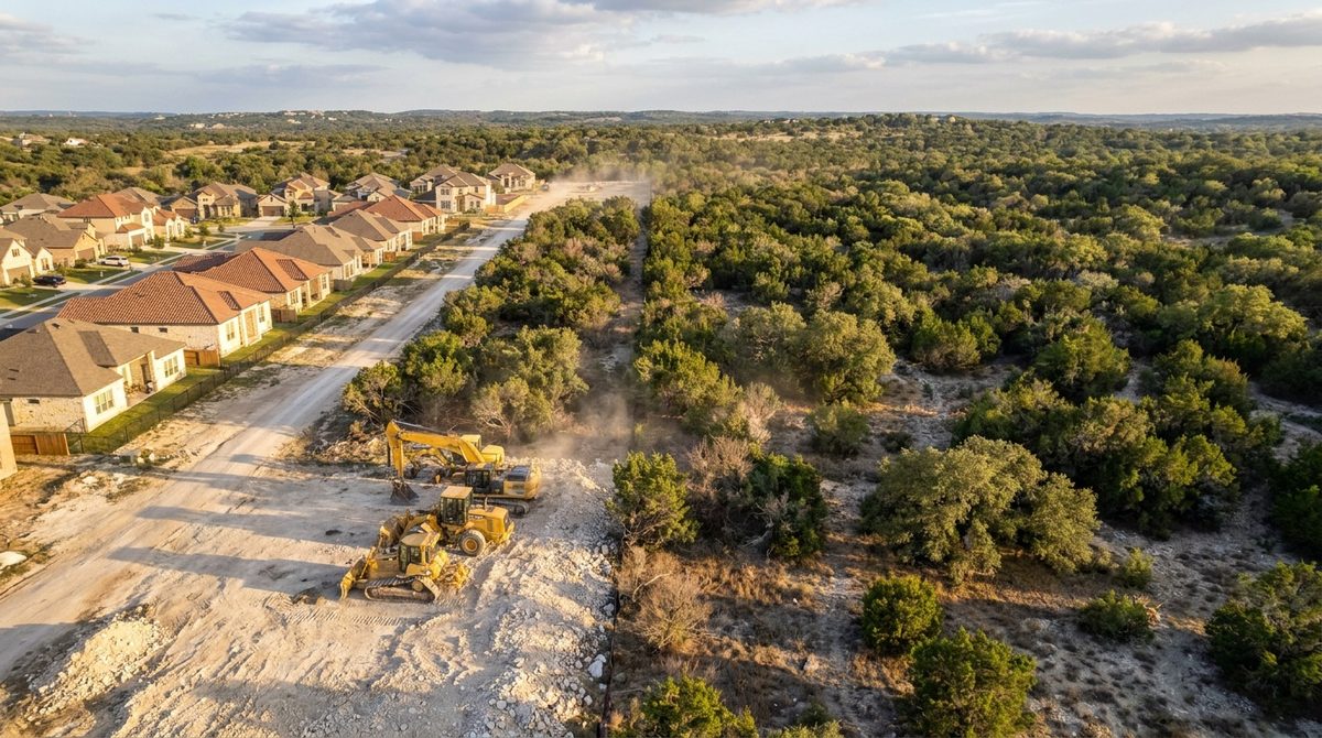
If your neighborhood sits at the edge of a city — where developed land meets open land, forests, or grasslands — there's a high likelihood you're in what fire agencies call the Wildland-Urban Interface, or the WUI. Most homeowners have never heard this term. But it's becoming one of the most consequential classifications a property can carry, with real implications for insurance, compliance, and property value.
// In This Guide
// 01 What the Wildland-Urban Interface Actually Is
The Wildland-Urban Interface is the zone where developed residential land meets — or mixes with — undeveloped wildland vegetation. In plain terms: it's where neighborhoods sit next to, or within, areas that carry enough vegetation to spread wildfire.
Fire agencies use the term because this transition zone is where the vast majority of structure losses in wildfires occur. The vegetation surrounding WUI properties — trees, brush, cedar, dry grass — acts as a continuous fuel path from the wildland directly to the structure. A fire that starts half a mile away in open land doesn't need much help reaching a home that isn't buffered from that fuel chain.
// 02 How to Know If You're in the WUI
The clearest signal is geography: if your neighborhood sits adjacent to open land, forest, grassland, or significant native vegetation, you're likely in or near a WUI zone. But there's more than a visual assessment.
// How to Confirm Your WUI Status
Three ways to verify
- FEMA and state fire agency maps: The USDA Forest Service and FEMA publish national WUI maps. Your property's designation is publicly accessible. In Utah, HB 48 created formal WUI boundary designations that are county-level public records.
- Texas A&M Forest Service: In Texas, the Texas A&M Forest Service maintains fire risk zone and WUI boundary data. Your county's fire department or emergency management office can confirm your specific classification.
- Your insurance carrier: If your insurer has recently changed your premium, added a wildfire surcharge, or flagged your property in a renewal review, there's a strong likelihood they've already classified you as WUI.
// 03 What WUI Status Means for Your Property
Being in the WUI has three practical consequences that homeowners need to understand — and none of them go away by ignoring the classification.
Insurance — Premiums, Coverage, and Carrier Risk
Insurance companies are scrutinizing WUI status more closely than at any previous point. Properties in high-risk fire zones without documented defensible space are seeing higher premiums, reduced coverage limits, and in some cases carriers declining to renew policies altogether. Having verified defensible space documentation on record is one of the most practical ways to protect your coverage — and increasingly, your carrier may require it.
Compliance Requirements — Mandates and Fees
In Utah, HB 48 makes defensible space compliance mandatory for any property inside the designated WUI boundary. Fees for non-compliance are annual and accumulate. Critically: completing the clearing without documentation does not satisfy the requirement. The law requires verified proof that defensible space was established — clearing without a verifiable record doesn't count.
In Texas, there is no statewide mandate yet — but local regulations in high-risk areas and fire districts are moving in that direction. Staying ahead of that curve is significantly cheaper than responding to it retroactively.
Property Value — Disclosure and Market Position
Wildfire risk is increasingly a formal part of real estate transactions. Buyers and lenders are examining fire risk disclosures more carefully. A property with documented defensible space is in a measurably stronger position than one without — both in negotiation and in financing. A property without documentation in a disclosed high-risk zone is a liability that sophisticated buyers and appraisers now price in.
"The homeowners who face the worst outcomes in wildfires aren't always in the highest-risk areas. They're the ones who knew the risk existed and didn't act on it."
— ClearGround, Austin TX · Salt Lake City UT
Not sure of your WUI status? ClearGround's RTK pre-scan assesses your property's fire risk, zone requirements, and compliance needs before we quote anything.
Book a Free Site Scan →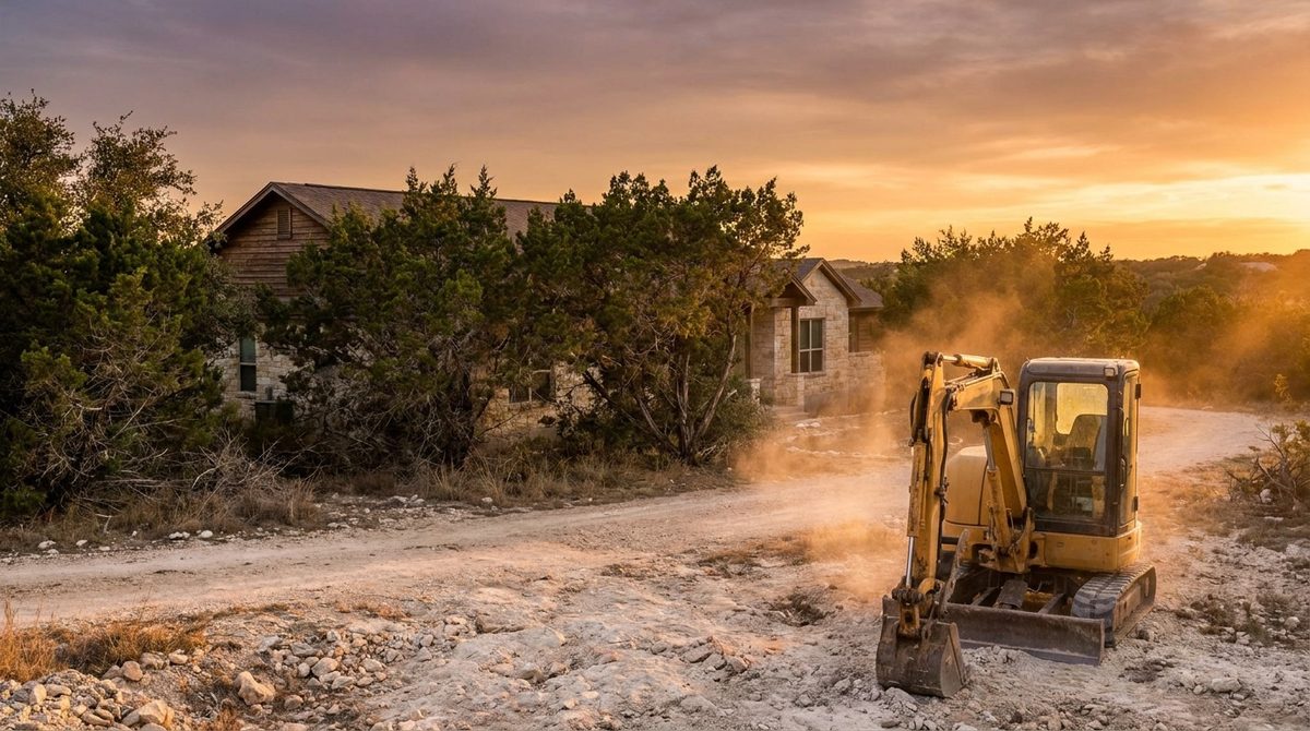
// 04 Texas Hill Country vs. Utah Wasatch Front
Both markets are in the WUI. The specific risks, vegetation, and compliance frameworks differ.
Cedar Is the Accelerant. Firewise Is the Framework.
Ashe juniper (cedar) is the dominant WUI fuel in Central Texas. It's highly volatile, aggressively spreading, and often the densest vegetation on Hill Country properties. Cedar thickets carry fire faster than almost any other native Texas vegetation — and they grow back aggressively once cleared.
Texas doesn't have a statewide WUI defensible space mandate, but Firewise and NFPA standards are the accepted compliance frameworks. Insurance carriers in high-risk Hill Country zip codes are increasingly asking for documented evidence of compliance at renewal.
HB 48 Makes It a Legal Requirement.
Salt Lake City and the Wasatch Front sit in one of Utah's highest-designated wildfire risk zones. Utah's fire seasons are lengthening, and the Wasatch Front's combination of steep terrain, dry summers, and dense suburban-wildland transition has made it a priority target for state fire management policy.
HB 48 creates a mandatory compliance framework — not a recommendation. If your property falls inside the WUI boundary, defensible space is legally required and must be documented. Annual fees apply to non-compliant properties. The documentation requirement is specific: a verified record, not a property owner's assertion.
// 05 What WUI Homeowners Can Do About It
Being in the WUI doesn't require panic — it requires a plan. Here are the four steps every WUI homeowner should take.
Confirm Your Classification
Verify your WUI status through FEMA maps, your state fire agency, or your insurance carrier's risk assessment. In Utah, check your county's HB 48 WUI boundary designation. In Texas, check with the Texas A&M Forest Service or your local fire district.
Establish Documented Defensible Space
Clear vegetation in the zones closest to your structure to NFPA and Firewise standards. For most residential properties, forestry mulching is the most efficient method — one machine, one pass, no debris to haul or burn. The mulch layer left behind is ground cover that doesn't carry fire.
Get RTK Documentation
Clearing without documentation satisfies the risk but not the compliance requirement. RTK-verified records — a geo-referenced before/after model showing zone measurements and cleared acreage — are what your insurer and state authority require. This is the proof that clears the way for coverage and fee reductions.
Schedule Annual Maintenance
Defensible space isn't a one-time project. Vegetation grows back, fuel loads rebuild, and documentation becomes outdated. Annual or biannual maintenance keeps your buffer zones effective and your records current — so when fire season arrives, or your insurer calls, you have current proof of compliance.
// Frequently Asked Questions
What is the Wildland-Urban Interface (WUI)?
The WUI is the zone where developed residential land meets or mixes with undeveloped wildland vegetation. Properties in the WUI sit in territory where surrounding vegetation creates a continuous fuel path that allows wildfire to travel toward structures. Fire agencies use the WUI designation to identify areas of elevated wildfire risk.
How do I know if I'm in the WUI?
If your neighborhood sits adjacent to open land, forest, grasslands, or significant native vegetation, there's a strong likelihood your property falls within or near a WUI zone. FEMA and state fire agencies maintain WUI maps. In Utah, HB 48 created formal WUI boundary designations. In Texas, the Texas A&M Forest Service maintains fire risk zone data. Your insurance carrier's recent premium changes may also signal a WUI reclassification.
Is defensible space legally required in the WUI?
In Utah, yes. HB 48 mandates defensible space compliance for properties inside the WUI boundary, with annual fees for non-compliance. The requirement includes documentation — clearing without a verified record does not satisfy the law. In Texas, there is no current statewide mandate, but local fire districts and municipalities in high-risk areas are implementing their own requirements.
What's the best way to create defensible space in the WUI?
For most residential properties, forestry mulching is the most efficient method — one machine, one pass, no burn permits, no debris hauling. Mulched material stays on site as ground cover that doesn't carry fire. Clearing should follow NFPA and Firewise zone specifications, and RTK documentation should be produced at project close to satisfy insurance and compliance requirements.
// Ready to Protect Your WUI Property?
Get Ahead of
Fire Season.
ClearGround clears to Firewise and NFPA standards and delivers RTK-verified documentation on every fire mitigation project — the proof your insurer and state require before the season starts.
Book a Free Site ScanServing Austin, TX · Texas Hill Country · Salt Lake City, UT