TX contractor LIC
UT contractor INS
FAA PART 107 FAA 107
Insurance $2M GL
Technology About Contact
ClearGround Land Clearing Rough Grading to Spec
S1 — Land Reclamation · Sub-Service

Grade Verified.
Not Just Leveled.

A level-looking lot and a spec-compliant lot are not the same thing. ClearGround cuts and fills to your engineered drainage plan and verifies the finished grade to ±0.5cm RTK accuracy before any next-phase contractor inherits the site. No re-grading surprises. No drainage review failures.

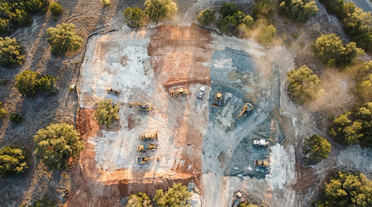
Rough grading for pool builds, infill new construction, and residential site prep in Austin and the Hill Country. Often bundled with lot clearing as a single mobilization.

What "Verified to Spec" Actually Means
−2cm −1cm ±0 +1cm +2cm
RTK AccuracyElevation confirmation across full lot
±0.5cm
Drainage FlowVerified to engineered plan
To Plan
As-Built DeliverableDigital twin to next trade
3D Twin
Standard gradingEye-leveled, hand-checked
±3–5cm
±0.5cm
RTK Grade Accuracy
1–3 Days
Typical Duration
48hr
Quote Turnaround
3D Twin
As-Built Delivered
1 Pass
Drainage Review Ready
Service Overview — Rough Grading to Spec

The grade your engineer
specified — confirmed,
not assumed.

Rough grading to spec is the process of cutting and filling a cleared site to match the engineered drainage plan — and then verifying the finished surface against that plan using RTK drone survey to ±0.5cm accuracy. It's not eyeballing a slope with a level. It's a documented, measurable surface that your structural engineer, pool builder, or permit reviewer can open and interrogate as a 3D model.

Most grading contractors deliver a surface that looks right. ClearGround delivers a surface that's been measured. The RTK as-built goes to your next trade as a verified baseline — not a site they're seeing for the first time and hoping someone got the slope right.

Most efficiently run bundled with lot clearing in the same mobilization. One pre-scan covers both scopes. One crew, one visit, one handoff.

What We Verify 01
Elevation to Plan
Finished grade elevation confirmed against design benchmark across the full lot surface. Every high and low spot located — not assumed to be within tolerance.
What We Verify 02
Drainage Flow Lines
Positive drainage away from structure, swale locations, and retention areas verified against the engineered plan. Drainage review passes first submission when the data matches the plan.
What We Verify 03
Cut / Fill Volumes
Total material moved calculated from the elevation delta between pre-grade and post-grade surfaces. Useful for project accounting, earthwork confirmation, and material import/export reconciliation.
The Difference

Graded vs.
Graded and verified.

Standard Grading
Grade checked with hand level and operator judgment
Drainage flow assumed — not measured
No deliverable for engineer or permit reviewer
Next trade inherits the grade blind
Drainage review failure discovered post-pour
Re-grading cost and delay falls on someone
VS
ClearGround Rough Grading
RTK drone confirms elevation to ±0.5cm across full lot
Drainage flow verified against engineered plan
3D as-built digital twin delivered to engineer
Next trade inherits a verified, measurable baseline
Drainage review passes first submission
Fixed price from pre-scan data — no scope surprises

THE GRADE YOUR ENGINEER SIGNED OFF ON IS THE GRADE WE DELIVER.

AT ANY PHASE OF YOUR PROJECT
GET AN UNBIASED VIEW OF YOUR SITE

1/5

PRE-GRADING

PHASE 01 — EXISTING CONDITIONS MAPPED FIRST

WE KNOW THE EXISTING SURFACE BEFORE WE MOVE IT.

The Mavic 3 Enterprise RTK drone captures the existing surface elevation before any grading begins. This pre-grade surface is the baseline — compared against the engineered design grade to calculate exactly where cut is needed and where fill is needed. The cut/fill analysis is accurate to centimeter level, so the grading crew knows before they start what material is moving and where it goes. No guessing at high spots. No discovering fill needs mid-job.

±0.5CM PRE-GRADE SURFACE · CUT/FILL ANALYSIS FROM DESIGN PLAN · MATERIAL VOLUME ESTIMATED BEFORE MOBILIZATION

Pre-Grade Elevation Surface DroneDeploy terrain model of cleared lot Cut/fill analysis overlay — warm colors =
Illustrative — representative visualization
2/5

GRADING EXECUTION

PHASE 02 — CAT 308E2 CR. GRADE TO PLAN.

COMPACT RADIUS. PRECISION GRADE.

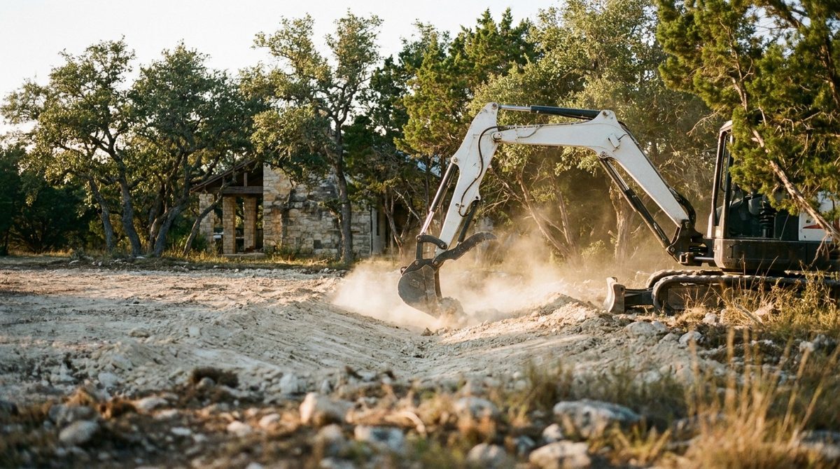
The CAT 308E2 CR mini excavator is the grading machine for residential and infill sites — its compact-radius design works on tight lots without tail swing damage to adjacent structures or root zones. Cut material is moved to fill areas per the cut/fill plan. Swales, positive drainage slopes, and retention areas are shaped to the engineered plan. The operator works from the pre-grade analysis, not from a mental picture of what level looks like.

CAT 308E2 CR COMPACT RADIUS · 66HP · 15FT DIG DEPTH · ZERO TAIL SWING · SWALE FORMATION · DRAINAGE SHAPING

Pre-Grade Elevation Surface DroneDeploy terrain model of cleared lot Cut/fill analysis overlay — warm colors =
3/5

MID-GRADE CHECK

PHASE 03 — CONFIRMED AS WE GO, NOT AFTER

GRADE CHECKED MID-JOB.

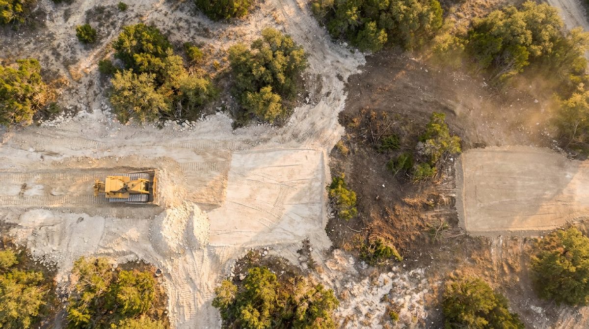
On multi-day grading jobs, an intermediate RTK scan confirms elevation progress against the design plan before the crew continues. If a section is running high or low, it's corrected in the current pass — not discovered when the final survey runs and the concrete truck is already scheduled. The intermediate scan adds less than an hour to the job and eliminates the re-grading scenario entirely.

MID-JOB RTK ELEVATION CHECK · DELTA AGAINST DESIGN GRADE · CORRECTIONS MADE CURRENT PASS · NO RE-GRADING

Pre-Grade Elevation Surface DroneDeploy terrain model of cleared lot Cut/fill analysis overlay — warm colors =
Illustrative — representative visualization
4/5

COMPLETION VERIFICATION

PHASE 04 — GRADE CONFIRMED BEFORE HANDOFF

SPEC MET. DOCUMENTED.

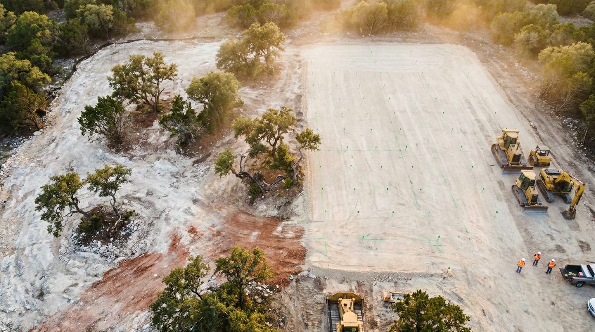
Final RTK scan confirms the finished surface against the engineered design grade across every point on the lot. Elevation accuracy to ±0.5cm. Drainage flow lines confirmed. Swale locations verified. Cut/fill volumes calculated from the before/after elevation delta. A signed RTK accuracy report accompanies the deliverable — not a verbal confirmation that it looks right. The site doesn't leave our hands until the numbers match the plan.

FINAL RTK ELEVATION SURVEY · ±0.5CM ACCURACY · DRAINAGE VERIFICATION · CUT/FILL VOLUME CALCULATION · SIGNED REPORT

Pre-Grade Elevation Surface DroneDeploy terrain model of cleared lot Cut/fill analysis overlay — warm colors =
Illustrative — representative visualization
5/5

THE DELIVERABLE

PHASE 05 — WHAT YOUR ENGINEER RECEIVES

THE AS-BUILT YOUR NEXT TRADE USES.

Georeferenced as-built elevation surface on DroneDeploy — shareable with your structural engineer, GC, pool builder, or permit reviewer via link. The as-built is measurable, exportable to CAD, and permanent. Your engineer uses it to confirm the graded surface matches the drainage design before stamping the drainage review. Your pool builder uses it to plan the dig. Your foundation contractor uses it to confirm the bearing surface. One deliverable, multiple downstream uses, zero additional survey required.

GEOREFERENCED AS-BUILT · DRONEDEPLOY PLATFORM · CAD EXPORT · SHAREABLE LINK · DRAINAGE REVIEW READY · PERMANENT RECORD

Pre-Grade Elevation Surface DroneDeploy terrain model of cleared lot Cut/fill analysis overlay — warm colors =
Illustrative — representative visualization
Transparent Pricing

$2,500–$8,000 (to $12K+ w/ rock).
Based on what's actually on your lot.

Rough Grading to Spec — S1 Sub-Service
Rough Grading
to Spec
Cut and fill to engineered drainage plan. RTK-verified finish grade to ±0.5cm. As-built digital twin delivered. For pool builds, infill new construction, and residential site prep. Most efficiently bundled with lot clearing as a single mobilization.
$2,500–$8,000
Residential lot · 0.25–1 acre · Austin metro and Hill Country
Duration: 1–3 Days · Size: 0.25–1 Acre Residential Lot
Equipment: CAT 308E2 CR + Grading Attachments · DJI Mavic 3 RTK
Workflow: InSite Elevation Pro · DroneDeploy
Includes: Pre/Post RTK Scan · Cut/Fill Analysis · As-Built 3D Twin
What Drives the Price Up
Grade Change Magnitude
A flat lot with minimal elevation change is a half-day grading job. A sloped Hill Country lot with 4+ feet of grade change from front to back involves substantially more cut/fill work — more material moved, more passes, more time. The pre-grade scan calculates this before we quote.
Drainage Plan Complexity
A simple positive-slope-away-from-structure plan is straightforward. Multiple flow paths, swale networks, retention areas, or complex lot geometry with multiple drainage zones take more machine time to shape and verify precisely.
Rock Encountered During Grade
If the grading scope hits limestone below the cleared surface, scope shifts to rock milling or hydraulic hammer excavation rates. The pre-scan identifies surface rock indicators — deeper formation is flagged as a risk item in the proposal rather than a surprise on the invoice.
Import or Export Material
When the cut/fill analysis shows more fill needed than cut material available on site, fill has to be imported. When cut exceeds fill, excess material has to leave. Both scenarios add cost. The pre-grade elevation analysis quantifies this before mobilization — so it's in the bid, not discovered mid-job.
Included in Every Job
Pre-grade RTK elevation scan
Cut/fill analysis from design plan
Post-grade RTK verification
As-built 3D digital twin
Veteran operator + all fuel
Typical Project Flow

Grading is usually phase three.

01
RTK Site Scan
Existing conditions mapped before any work
02
Lot Clearing
Vegetation removed, stumps grubbed
03
Rough Grading
Cut/fill to plan · RTK verified · You are here
04
Excavation
Pool shell, pad prep, or foundation dig
05
As-Built Twin
3D model delivered to next trade
Equipment & Specifications

The iron behind
the precision.

Survey — Grade Verification
DJI Mavic 3 RTK
Pre-Grade · Mid-Job · As-Built
DJI Mavic 3 Enterprise RTK
Survey-grade RTK drone captures pre-grade, mid-job, and as-built elevation surfaces. The elevation delta between pre-grade and as-built confirms cut/fill volumes and verifies the finished surface against the design plan to ±0.5cm.
Accuracy
±0.5 cm
Output
Ortho + 3D Twin
Sensor
4/3 CMOS 20MP
Flight Time
45 min
Software — Grade Workflow
InSite + DroneDeploy
Cut/Fill Analysis · As-Built Delivery
InSite Elevation Pro + DroneDeploy Interface
InSite Elevation Pro processes the RTK scan data against the design grade to generate cut/fill maps before the machine starts. DroneDeploy hosts the as-built model and delivers it to your team as a shareable, measurable link.
Cut/Fill Analysis
InSite Pro
As-Built Platform
DroneDeploy
CAD Export
Yes
Shareable Link
Yes
Who This Service Is For

Anyone whose next phase
depends on the grade being right.

ICP 01 / Primary
Pool Builders
Your Dig Starts on a Grade That's Been Measured.

The lot was cleared by someone else. Now your crew shows up to dig and the grade hasn't been verified — just eyeballed. ClearGround's grading as-built tells your excavation crew exactly what the surface is before they start. No re-grading surprises after the pool shell is placed. Drainage verified to plan before your concrete schedule is locked.

Typical Pathway: Lot clearing → Rough grading → RTK as-built → Pool shell excavation
How we work with pool builders →
ICP 02 / Primary
Infill Developers
Drainage Review Passes First Submission.

A failed drainage review adds weeks to your permit timeline and costs you carrying costs you didn't budget. ClearGround's RTK as-built gives your engineer the elevation surface data they need to confirm drainage compliance before submission — not after the city flags it. One mobilization handles clearing, grading, and documentation for your engineer's review package.

Typical Pathway: Clearing + grading bundled → As-built → Engineer review → Permit submission
How we work with developers →
ICP 03 / Secondary
General Contractors
Inherit a Verified Baseline. Not a Guess.

When you take over a site from a clearing contractor, you're usually inheriting a grade nobody documented. ClearGround's as-built is the verified surface baseline your foundation crew, framing crew, or landscape contractor references without having to commission their own survey. One deliverable that answers "is the grade right?" before anyone asks it.

What You Get: Verified elevation surface · Drainage confirmation
Cut/fill volumes · Shareable DroneDeploy link for your subs
Frequently Asked

Questions About
Rough Grading to Spec

Rough grading establishes the major drainage contours, cut/fill elevations, and subgrade surface to the engineered plan. It's what happens before the foundation, pool shell, or hardscape goes in. Finish grading is the fine-grading that happens after construction — final topsoil, lawn prep, landscape grade. ClearGround handles rough grading: the structural, drainage-critical surface your construction sequence requires. Finish grading is typically handled by a landscape contractor at the end of the project.
Yes — and this is the most efficient configuration. One pre-scan covers both the clearing plan and the cut/fill analysis. The CAT 299D3 XE handles clearing while the CAT 308E2 CR handles grading — both machines on site at the same time, one mobilization fee, one RTK verification at the end covering both scopes. Bundled clearing and grading is consistently faster and cheaper than scheduling them as separate visits with separate mobilization fees.
Yes — the engineered drainage plan is the spec we grade to. We need the design grade elevations, drainage flow directions, swale locations, and any retention features from your civil or structural engineer before we can do a cut/fill analysis. If you don't have a stamped drainage plan yet, we can grade to general positive drainage away from structure — but that's not spec grading, and it won't satisfy a drainage review. Most pool builders and developers have the drainage plan in hand before they're ready to mobilize. If yours is still in process, we can pre-scan the site and have the proposal ready the day the plan is stamped.
The pre-grade RTK scan and cut/fill analysis tells us the net balance before we start — whether cut exceeds fill (material has to leave) or fill exceeds cut (material has to come in). Both scenarios are quantified in cubic yards from the elevation data, not estimated. Import fill cost and haul-off cost are included in the proposal when applicable. For lots with significant fill deficits, we coordinate with a fill source. For lots with excess cut that can't be spread on-site, we coordinate haul-off. Either way, it's in writing before we mobilize.
The RTK as-built is a georeferenced elevation surface of the graded lot — accurate to ±0.5cm — hosted on DroneDeploy and exportable to CAD. Your engineer opens it, overlays it against the design grade, and can confirm drainage compliance without driving to the site or commissioning a survey crew. For city drainage review submissions in Austin, the as-built data is formatted to match what the reviewer expects to see — flow directions, spot elevations, swale depths. Drainage review passes on first submission when the graded surface matches the plan, and the RTK data proves it does.
±0.5cm is survey-grade accuracy — the same tolerance used by licensed land surveyors with total stations. For context, a standard hand-level grade check is accurate to ±3–5cm at best. That gap matters when drainage is designed to flow at 1–2% grade: a 3cm elevation error on a 15-foot run can reverse the drainage direction. RTK accuracy means the grade you specified is the grade that's there — not approximately there. For drainage review purposes, ±0.5cm is the threshold that lets your engineer certify the as-built matches the design without caveats.

The grade your engineer
specified. Confirmed.

Pre-scan maps the existing surface. Cut/fill analysis runs against your drainage plan. Grade is verified to ±0.5cm at completion and delivered as a 3D as-built. 48-hour quote turnaround from Austin.