Mesquite and cedar crowd out grazing land. One pass opens it back up.
Ranch & Pasture Restoration in Austin & the Texas Hill Country
Pasture restoration mulches mesquite, cedar and brush in place so grazing and hunting land opens back up. It is for ranch, estate and lease owners in Austin and the Texas Hill Country. Rates run $2,800–$3,900 per acre for typical stands, up to $5,200 per acre when dense, typically 1–5 days per site. The price covers the site walk, mulching and cleanup.
Pasture restoration is not one size. A large working cattle ranch with mature mesquite is a different project than a hunting property that has been neglected for a decade. We price by what your terrain requires, and the site walk shows that before we quote.
Invasive Species — Mesquite
Mesquite Clearing & Root Extraction
Mesquite resprouts from the root crown, so it needs a plan. We mulch everything above grade in place. Where you want it gone for good, root extraction pulls the crowns. Tree mulching and root extraction is priced as its own scope at $5,000–$8,000 per acre (dense mesquite to $12,000 per acre).
Duration: 1–5 days · Equipment: CAT 299D3 XE + FAE Head
$2,800–$3,900 moderate, $4,000–$5,200 dense
/ acre
Mulching only. Extraction is quoted as its own scope. Site walk confirms density.
What drives the price up
Mature mesquite with large trunks takes more mulching head time per tree than young growth. Properties unmaintained for 10+ years have denser stands. Rough terrain slows the machine and adds wear.
Invasive Species — Juniper
Juniper & Cedar Pasture Clearing
Ashe juniper is the main brush problem across much of the Hill Country. We clear it in place with nothing to haul. Ashe juniper does not resprout once cut below the lowest green limb, so regrowth comes from seedlings.
Duration: 1–5 days · Equipment: CAT 299D3 XE + FAE Head
$2,800–$3,900 moderate, $4,000–$5,200 dense
/ acre
Priced per acre by cedar density and terrain.
What drives the price up
Dense cedar, where you cannot see daylight through the canopy, runs slower than open mixed stands. Cedar mixed with live oak needs selective passes. Rocky terrain limits machine speed.
Infrastructure Access
Fence Line & Road Clearing
Overgrown fence lines hide damage and push on posts. We clear corridors along fence lines and ranch roads in a single pass. For heavy fence-line brush see field and brush clearing.
Duration: 0.5–2 days · Equipment: CAT 299D3 XE + FAE Head
$1,600–$2,400 mowing, $2,000–$5,200 mulching
/ acre of corridor
Priced per acre of corridor (length × width).
What drives the price up
Fence lines with mature mesquite or established cedar take longer than young brush. Existing hardware needs careful maneuvering around posts and wire. Drainage crossings and steep side slopes add time.
Large-Scale Restoration
Full Pasture Restoration
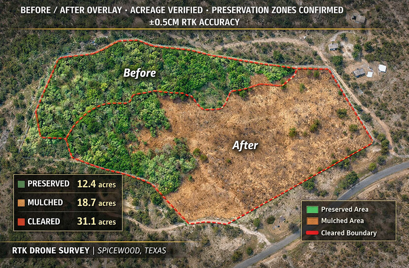
For properties that have gone from working ranch to cedar thicket. We clear systematically by zone and keep a before-and-after photo record.
Duration: 3–14+ days · Equipment: CAT 299D3 XE + FAE Head
$2,000–$5,200
/ acre
Priced by density across the property. Phased clearing available.
What drives the price up
Mixed stands with varying densities take longer per acre than uniform growth. Significant limestone may need rock milling. Preserving native trees and specimen oaks slows the passes. Phased projects carry a cost per mobilization.
Wildlife Habitat
Hunting Property & Wildlife Habitat Management
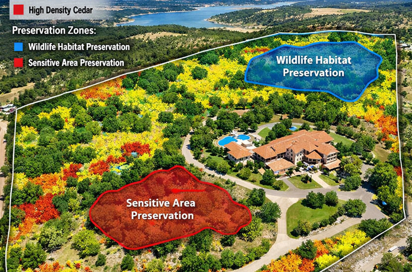
Selective clearing can create browse edges, native grass openings and travel corridors while leaving cover in place. We work from your wildlife biologist's plan, or help you sketch one from aerial imagery first. See the wildlife valuation notes below.
Duration: 1–10 days · Equipment: CAT 299D3 XE + FAE Head
Selective habitat clearing, with edges and openings rather than clearing everything, takes more planning and slower passes. Food plots and native plantings need careful boundary management.
Access & ROW
Right-of-Way & Easement Clearing
Pipeline easements, utility ROWs and ranch access easements need clean boundary clearing. We fly the corridor before clearing and again after, so you have a before/after record that we stayed inside the boundary you marked.
Duration: 1–5 days · Equipment: CAT 299D3 XE + FAE Head
$1,600–$2,400 mowing, $2,000–$5,200 mulching
/ acre of corridor
Priced per acre of corridor (length × width). Before and after photos included.
What drives the price up
Narrow ROW widths with tight boundaries take longer per linear foot than wide corridors. Mature invasive growth on an unmaintained easement takes more machine time. Terrain needing several machine access angles adds repositioning.
Included in Every Price
Site Walk and Written Quote
Before and After Photos
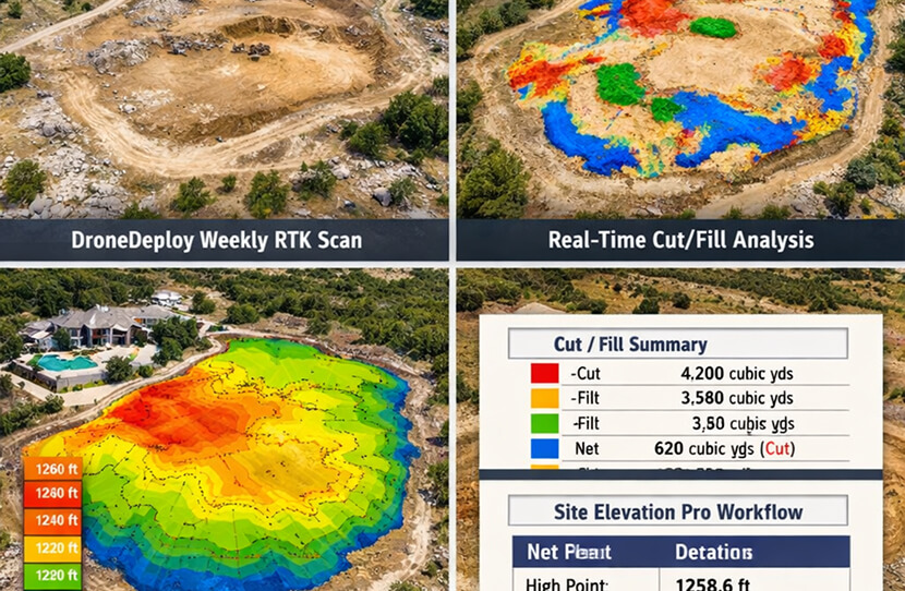
Optional: drone scan and 3D surface model of the site, $500–$1,500 per scan.
Operator, Fuel and Machine Time
No Burning
Mulch Left On Site
Species We Remove
Honey MesquiteAshe Juniper (Cedar)Prickly PearAgaritaHuisacheTasajilloGreenbriarShin Oak (selective)Native Grasses — PreservedLive Oak — Preserved by DefaultPecan — Preserved by DefaultWildlife Corridor Cover — Selective
What Happens After the Machine Leaves
Soil Health & Grass Recovery
Most ranchers know mesquite and cedar are a problem. The method matters too. Mulching in place leaves the soil covered instead of bare.
Why Mulch-In-Place
Your Soil Profile Stays Intact
Burning removes the organic matter and hauling removes it and adds a tipping bill. Mulching in place leaves the material on the ground, where it covers the soil, slows moisture loss and reduces erosion.
Nothing is burned, so there are no burn-ban delays and no smoke. Ground cover stays in place until grass fills in.
Grass Recovery
Recovery Depends on the Seed Bank and Rain
Where native grass roots are still there, opening the canopy lets light and rain reach them. Where cedar or mesquite has shaded the ground for decades, the seed bank may be thin and overseeding helps. Texas A&M AgriLife Extension and your local NRCS office can advise on grass mixes for your soil.
Regrowth is part of the plan. Mesquite resprouts, cedar seedlings come back, and an annual maintenance visit keeps the land productive without a full re-clearing.
See what changed at every phase
Every Phase of Your Pasture Restoration — Documented
Phase 01
Pre-Restoration Site Walk
We Look Before We Clear.
We walk your property with you. That shows mesquite and cedar density by zone, where native grass still has a foothold, water features and drainage that affect the plan, and the specimen trees and preserve zones you want untouched.
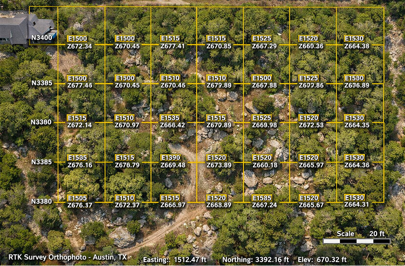
The clearing plan comes from the walk. You approve it before we roll the machine. An optional drone scan adds a 3D surface model of the site, $500–$1,500 per scan.
Site Walk With YouOptional Drone ScanMesquite / Cedar Density ZonesWater Feature IdentificationSpecimen Tree Marking
Phase 02
Systematic Clearing
Zone by Zone. No Gaps.
Our CAT 299D3 XE with FAE mulching head works the property by zone, following the plan you approved. High-priority areas come first: dense mesquite near water, cedar blocking pasture access and overgrown fence lines. Specimen trees and preserve areas stay where we marked them.
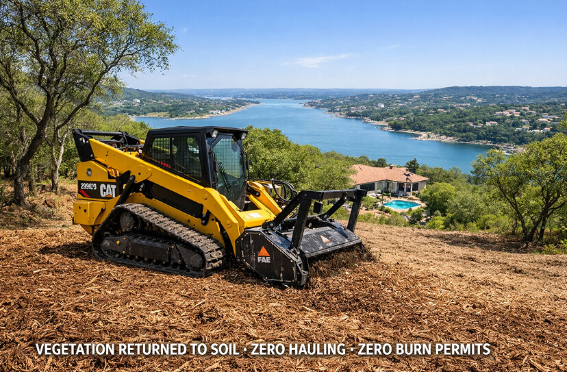
Mesquite and cedar are ground in place at chip level and left as a mulch layer. Nothing is burned and nothing leaves the ranch. The pasture floor stays intact.
CAT 299D3 XEFAE Mulching HeadZone-Based SequenceChip-Level MulchMulch Stays On Site
Phase 03
Progress Documentation
Progress You Can See.
On multi-day projects we take progress photos between clearing sessions to document what has been cleared, what remains and whether any preserve zone was approached. You don't have to drive out to check on the crew.
If an unexpected terrain feature changes the sequence, such as a dry creek bed, a limestone outcrop or a cluster of native trees, we document it and flag it before proceeding.
Mid-Job PhotosCleared Zone ProgressPreserve Zone CheckDeviation Notes
Phase 04
Completion Check
Before & After, Acre by Acre.
At the end we walk the finished restoration with you and compare it to the before photos, zone by zone. Cleared boundaries, mulch coverage and preserved areas are all visible.
If anything was not completed per the approved plan, we address it before we leave the property.
Before / After ComparisonCleared Acreage CheckPreservation Zone ConfirmationPhoto Record
Phase 05
Deliverable
Your Ranch, Before and After.
You get before-and-after photos of the property. Share them with your ranch manager, lease hunters, a wildlife biologist or a lender. An optional drone scan adds a 3D surface model of the site, $500–$1,500 per scan.
Annual maintenance visits use these photos as the comparison point, so you can see how much regrowth occurred and where.
Before / After PhotosBefore / After ArchiveOptional Drone ScanAnnual Maintenance BaselinePrintable Photo Set
Start with a site walk.
Book a Site Walk and Get a Written Quote.
We walk your ranch with you, mark what stays and what goes, and price it by density. Written quote within 48 hours of the site walk. No obligation.
Pasture Restoration. Austin & Hill Country Ranches.
Mesquite and cedar mulched in place, with the ground left open.
Before / After — Mesquite & Cedar Removal
Single-Pass Mulching
Before Clearing
Cleared Pasture
CAT 299D3 XE
Ranch Mulching Rates
Ranch & Pasture Pricing for Central Texas
We price by species density and terrain. The ranges below are for forestry mulching in the Austin and Hill Country market. Root extraction for mesquite is quoted as its own scope.
Service
Duration
Acreage / Basis
Range
Mesquite Clearing — Moderate Density
1–3 days
1–10 acres
$2,800–$3,900 / acre
Mesquite Clearing — Heavy / Mature Stands
2–5 days
1–20 acres
$4,000–$5,200 / acre
Cedar / Juniper Clearing — Moderate
1–3 days
1–15 acres
$2,800–$3,900 / acre
Cedar / Juniper Clearing — Dense
2–5 days
1–20 acres
$4,000–$5,200 / acre
Tree Mulching & Root Extraction (mesquite)
0.5–3 days
0.5–5 acres
$5,000–$8,000 / acre; dense mesquite to $12,000/acre
Full Pasture Restoration
5–14 days
50–200+ acres
$2,000–$5,200 / acre; quoted at the site walk
Wildlife Habitat / Selective Clearing
1–10 days
1–50 acres
$2,800–$3,900 / acre
Brush / Mixed Invasive Clearing
0.5–3 days
1–10 acres
$2,000–$2,800 / acre
Fence Line / Road Clearing
0.5–2 days
Per acre of corridor (length × width)
$1,600–$2,400 mowing, $2,000–$5,200 mulching
ROW / Easement Clearing
1–5 days
Per acre of corridor (length × width)
$1,600–$2,400 mowing, $2,000–$5,200 mulching
Pricing includes operator, fuel and machine time. Highlighted rows are the core ranch services. Properties with significant limestone may need rock milling, priced separately. See pricing and the land clearing calculator.
Prices reviewed: September 2026. Ranges for Austin and Central Texas; your site walk sets the final number.
Site Walk and Written Quote
Before and After Photos
Optional: drone scan and 3D surface model of the site, $500–$1,500 per scan.
Operator, Fuel and Machine Time
No Burning
Mulch Left On Site
Cost-Share and Tax Valuation
Programs That Can Help Pay for Restoration
Two programs matter to ranch owners. Check eligibility before you clear, because some programs need approval first. This is general information, not tax or legal advice. Last reviewed: September 2026.
NRCS EQIP
Cost-Share for Agricultural Producers
The USDA Environmental Quality Incentives Program (EQIP) is for agricultural producers and non-industrial private forest owners. It can cost-share conservation practices such as brush management. Eligibility, ranking and payment rates are set by NRCS, and you apply through your local NRCS office.
We do not file EQIP applications. We can give you the site walk findings, the acreage plan and before-and-after photos to support your planning.
TPWD Wildlife Management
Wildlife Management Valuation
Texas lets qualifying agricultural land move to wildlife management use and keep its lower valuation. Habitat control, which includes brush management, is one of the qualifying activities. You file a wildlife management plan with your county appraisal district, and Texas Parks and Wildlife publishes the requirements.
Clearing work should follow your plan. We work from your wildlife biologist's plan and document what was cleared and where.
Recurring Maintenance
Pasture Management Maintenance Plans
Mesquite resprouts from its root crown after mulching, and cedar seedlings come up in open ground. An annual maintenance plan keeps your pasture productive and your fence lines clear.
Tier 01
Buffer
Perimeter, fence line and road upkeep
$2,000 / year
Billed Annually
CoverageSet at the site walk
Frequency1× Annual
ScopeFence lines + roads
RecordAnnual before/after photos
Tier 02
Protection
Selective clearing and regrowth management
$4,800 / year
Billed Annually
CoverageSet at the site walk
Frequency2× Annual (Spring + Fall)
ScopeRegrowth + fence lines
RecordSeasonal photo comparison
Tier 03
Estate
Whole-property management
$12,000 / year
Billed Quarterly
CoverageSet at the site walk
Frequency4× Annual (Quarterly)
ScopeFull pasture + infrastructure
RecordQuarterly photo record
Maintenance agreements are available to clients who complete an initial restoration project with Clear Ground. Each visit is compared against your project baseline flight so you can see how much regrowth occurred. Single visits run $2,000–$3,500 per visit.
Who This Is For
Ranch & Pasture Restoration Clients
We work best with landowners who treat clearing as an investment that needs upkeep, and who want a record of what they got.
Primary Client
Working Ranch & Livestock Operations
You run cattle, goats or sheep on land where mesquite and cedar have cut into pasture productivity. You need results you can measure.
Recognizing signals
Carrying capacity has dropped year over year
Mesquite density is increasing despite spot treatment
You own acreage in the Texas Hill Country and the cedar thicket that came with it is blocking views and turning good land into a management problem. You want it done right, documented, and without dump trucks on your roads.
Recognizing signals
Cedar has grown in significantly since purchase
Cedar is crowding springs and wet weather creeks
Views that attracted you to the property are gone
Previous clearing attempts regrew faster than expected
You manage a lease for deer, turkey, or quail — and habitat quality drives renewal rates. Selective clearing that creates browse edges and native grass openings while keeping cover can help habitat. You need a record that the work was done to plan.
Recognizing signals
Dense brush is eliminating sight lines and food plot access
Game camera counts are lower than the habitat should support
We walk the property before we quote, and we leave you a photo record of what was done.
01
Site Walk Before Every Project
We walk your property with you before the machine rolls. You see mesquite and cedar density by zone and water features on the ground. The clearing plan comes from that, not from a drive-by. An optional drone scan adds a 3D surface model of the site, $500–$1,500 per scan.
Planned From the Ground
02
Acreage Documented Before and After
Before and after photos show what changed, so you can see the cleared acreage before the invoice is written.
Before and After
03
Single Pass. Nothing to Haul.
Clear-and-haul leaves trucks on your roads and a tipping bill. Clear-and-burn leaves burn-ban delays and fire risk. Mulching in place does it in one pass and leaves the material on the ground.
Mulch In Place
04
Root Extraction for Resprouters
Mulching alone is a temporary fix for mesquite, which resprouts from the root crown. Where you want it gone, root extraction pulls the crowns and is quoted as its own scope, tree mulching and extraction together.
Mesquite-Specific
05
Specimen Tree Preservation
Every live oak, pecan and native tree you want kept is marked in the pre-clearing plan and photographed after. You tell us what stays.
Preservation Documented
06
Your Property on Record
Your before and after photos are yours to share with your ranch manager, wildlife biologist, insurance adjuster or lender.
Shareable Record
07
Insured and Registered
$2,000,000 per occurrence / $5,000,000 aggregate general liability (THREE, a Berkshire Hathaway company), $1,000,000 commercial auto, and Texas workers' compensation with $1,000,000 employer's liability. Certificate of insurance and additional-insured endorsement provided before work starts. Registered on Avetta and ISNetworld.
Insured
08
Annual Maintenance From Your Baseline
Every maintenance visit is compared against your post-clearing photos. You see how much regrowth occurred and where it concentrated.
Recurring Protection
09
Pricing Before the Machine Arrives
The site walk gives us what we need to quote a per-acre price before we start. Written quote within 48 hours of the site walk.
Priced by Density
FAQ
Ranch & Pasture Questions
Common questions from ranchers and Hill Country landowners about pasture restoration.
How much does pasture restoration cost?
+
Moderate mesquite and cedar stands run $2,800–$3,900 per acre. Dense stands run $4,000–$5,200 per acre. Tree mulching and root extraction is its own scope at $5,000–$8,000 per acre (dense mesquite to $12,000/acre). The site walk sets the number.
Will mesquite resprout after you clear it?
+
Yes. Mulching cuts mesquite above grade and it resprouts from the root crown. Root extraction pulls the crowns and is the lasting fix. Ashe juniper (Hill Country cedar) behaves differently. It does not resprout once cut below the lowest green limb, so its regrowth is from seedlings. Annual maintenance keeps both under control. Source: Texas A&M AgriLife Extension and Texas Parks and Wildlife.
How many acres per day can you clear?
+
It depends on density, trunk size and terrain. Light brush on flat ground runs about 2 to 4 acres a day. Moderate cedar or mesquite runs 1 to 2. Dense, mature mesquite runs 0.5 to 1. The site walk tells us which applies to you.
How long until I see native grass recovery?
+
It depends on rainfall and the seed bank. Where native grass roots are still alive under the brush, opening the canopy lets them respond. Where cedar has shaded the ground for many years the seed bank may be thin and overseeding helps. The mulch layer slows moisture loss while grass comes in.
Can EQIP or a wildlife management plan help with the cost?
+
Possibly. NRCS EQIP is for agricultural producers and non-industrial private forest owners and can cost-share brush management. Texas wildlife management valuation lets qualifying ag land keep its valuation, and habitat control is one qualifying activity. Both have their own applications and rules, and neither is filed by us. See the programs section above. This is not tax or legal advice.
Do you work on properties with significant limestone?
+
Yes. Hill Country limestone is normal ground for us. The CAT 299D3 XE handles rocky terrain, and surface rock slows the pass and adds head wear, which is in the price. Where clearing requires getting below grade, rock milling may apply and is priced separately.
Can you work around existing fencing?
+
Yes. The operator works up to the fence without touching it, clearing brush and saplings that have grown into it. Where brush has grown through the wire we work from the inside out and use hand tools where needed. Any damaged fence section is noted in the pre-clearing flight.
Do I need to be present during the clearing?
+
Not every day. We recommend being there for the pre-clearing walk to confirm what stays. After that the clearing follows the approved plan, and we share progress photos on multi-day jobs.
Every quote starts with a site walk.
Book a Site Walk
We walk your ranch or pasture with you, mark what stays, and send a written quote. No obligation to proceed.