


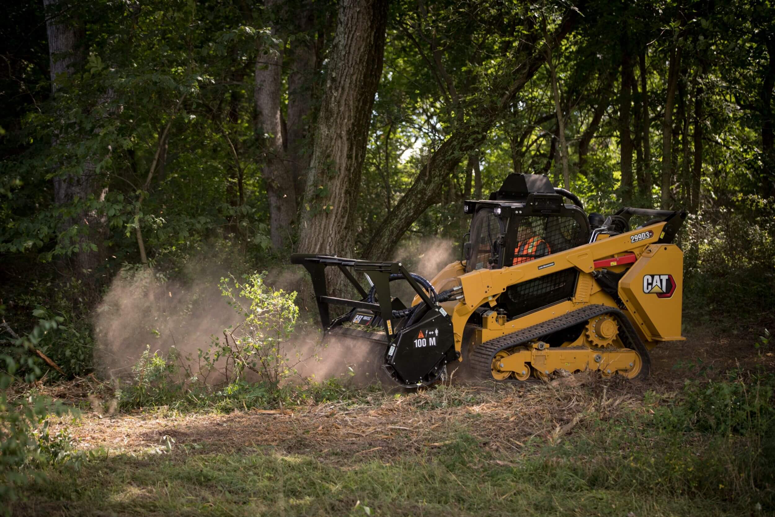
Texas Will Reimburse You Up to $2,000 an Acre to Clear Your Land.
The Texas A&M Forest Service is reimbursing Central Texas landowners up to $2,000 per acre to reduce hazardous brush with a forestry mulcher — the top reimbursement tier, and exactly the work we do. It's a reimbursement, not cash up front, and the application window closes July 14. This page walks you through the whole process — check your address, see the timeline, and book a free scan.
How the Grant Actually Works
It's a reimbursement, not a check in the mail and not a loan. You apply and map your property online before July 14. If your application is awarded, you hire an independent contractor — that's us — to do the fuel-reduction work, you pay for it, and the state reimburses you up to the per-acre rate. The heavy-equipment tier is forestry mulching, which is exactly our core service and the highest reimbursement rate available.
Confirm It Yourself in About Five Minutes.
Before you talk to anyone — including us — you can verify the two things that decide eligibility and one that decides how competitive you'll be. These are the Forest Service's own public tools. Open each, type in your address, and you'll know where you stand.
Is Your Address in an Eligible Area?
The Forest Service's official eligibility map. Search your address — if your parcel sits inside a funded polygon, you're in the program area. Essential for the four partial counties (Bastrop, Bell, Travis, Williamson), where only part of the county is covered.
Open the eligibility mapWhat's Your Wildfire-Risk Score?
The Texas Wildfire Risk Explorer (TxWRAP). It returns a burn-probability score from 1 to 10 for your exact location. A higher score is the single biggest driver of a competitive application — it's worth up to 20 of the 100 scoring points.
Check your risk scorePlan Your Treatment Areas
The Forest Service's "Plan My Land Operation" tool. Draw the areas you'd treat right on an aerial of your property and it tallies the acreage for each — the same kind of treatment map the application needs. We build the final map for you, but you can sketch it here first.
Open Plan My OperationTwo gates, a score, and a plan. Checks 01 and 02 are the facts your application is judged on — eligible location, and how exposed it is. Check 03 lets you rough out the treatment areas. If reading government maps and filing the form isn't how you want to spend your week, that's the part we handle: book a free scan and we run all three for your exact parcel and show you the receipts — the same verification you'll see in our proposal below.
You Point at the Cedar. We Map It, File It, Clear It.
The grant exists — the online application is what stops most people. So we handle that part. You don't fill out a government form or learn a mapping tool. You just show us the land.
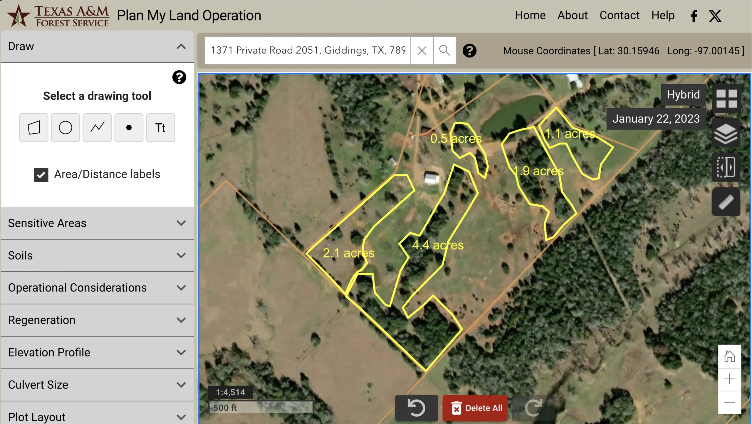
We Map Your Property
We survey your land with an RTK drone and lay out every treatment area over the aerial — acreage tallied, boundaries staked — the exact property map the application requires, and the same scan that documents your before/after in 3D.

We File Before July 14
We prepare and submit the online application and property map ahead of the deadline, so a missed form or a slow government portal isn't what costs you the reimbursement.
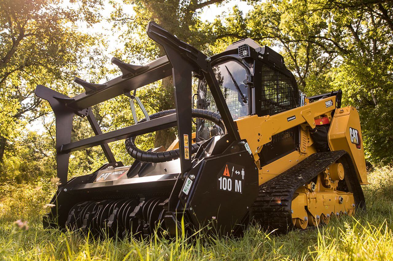
We Clear It — If You're Awarded
If your application is approved, our CAT 299D3 XE with an FAE mulcher head clears the brush in place. No burn piles, no haul-off. The state reimburses you up to the per-acre rate.
What Happens After You Apply.
This is the complete grant calendar, straight from the Forest Service's 2026–2027 program timeline. The most important thing to understand: you apply now, but the work and the money land months later. Plan around these dates.
Application Opens
The online application and "Map My Property" tool go live.
Application ClosesHard Deadline
The online window shuts. No late applications. The next cycle is a full year out.
Applications Reviewed
The Forest Service scores and ranks every application against the six factors below.
Decision Letters Emailed
You find out if you're awarded. (This is the precise date — not a vague "late August.")
Signed Acceptance Due
Awardees must sign and return their grant agreement to lock in the funding.
Pre-Inspections
The Forest Service inspects the site. No work can start before this happens — anything cleared early isn't reimbursable.
Treatment Window — We Do the Work
The actual clearing happens here, scheduled with you. For us that's a 3–5 working-day job once we're staged.
All Work + Post-Inspection CompleteNo Extensions
Every treatment must be finished and post-inspected by this date. Hard stop.
Reimbursements Processed
After the post-inspection clears, the state pays you back up to the per-acre rate. Funding period ends May 31, 2027.
Pick One Method — Per-Acre Rate Follows the Method.
The grant reimburses by how the work is done. You choose one method per application, and the per-acre reimbursement is set by that choice. Forestry mulching is the heavy-equipment tier — the top rate, and what most Hill Country cedar calls for.
Forestry Mulcher / Masticator
Dense, continuous cover on terrain with little to no slope — the classic Hill Country cedar thicket. Mulched in place, no burning, no haul-off. This is our core service.
Equipment + Hand Crews
Mixed conditions — hilltops, slopes, around structures and livestock. Heavy equipment where it fits, hand crews where it doesn't. Bulldozing is allowed for fire breaks only, never to clear-cut.
Chainsaws, Shears & Pole Saws
Steep, high-slope terrain where equipment can't safely work. Trees pruned up, understory cleared by hand. No heavy equipment in this tier.
Being Eligible Gets You in the Pool. These Six Factors Decide Who's Funded.
It's competitive — more landowners apply than there's funding for. The Forest Service ranks applications on six factors. The more of these you can speak to, the stronger your application. We build all six into how we map and write up your project.
Burn Probability
How likely the area is to burn — your 1-to-10 score from the Texas Wildfire Risk Explorer (Check 02 above). The biggest single factor.
Problematic Fuel Types
Heavy cedar, dense brush, and ladder fuels are exactly what the program targets — they score highest.
Homes Protected
Projects shielding more structures — yours plus neighbors' — rank above single-home jobs.
Defensible Space Created
Clearing the 0–100 ft home-ignition zone around a structure is the program's top priority.
Firewise USA® Status
Being part of a recognized Firewise community is a scoring bonus.
CWPP Alignment
Sitting in a county or city with an active Community Wildfire Protection Plan adds points.
The Rules That Disqualify a Project.
Most reimbursements that fall through fail on one of these. None of them are obscure — but every one is a hard line. We build the whole job to stay inside them.
What the Work Looks Like.
Dense Ashe juniper choking a Hill Country fence line, mulched in place to a clean, park-like finish — heritage oaks preserved and limbed up, mulch left on the soil, zero burning, zero haul-off. Exactly the heavy-equipment fuel reduction the grant reimburses.
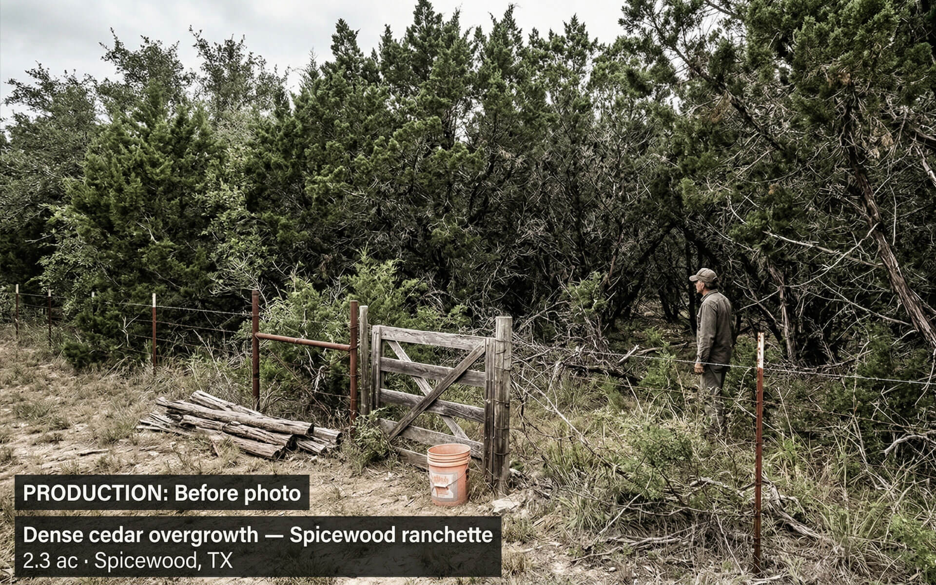
Cedar overgrown to the fence line — fuel load stacked, view and pasture lost.
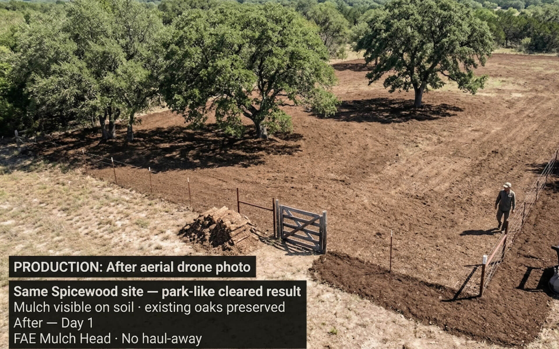
Cleared in place. Oaks kept, mulch on the soil, defensible space opened up.
Illustrative of typical Hill Country cedar fuel reduction. Every project ships a georeferenced before/after 3D digital twin of your own property.
No Mystery Lump Sum. Here's Exactly What You Get in Writing.
Before you commit to anyone, you should see how they quote. Every ClearGround proposal is a full document — your property mapped, your eligibility verified against the state's own data, the scope phased out, the bid itemized, and the grant math shown honestly. This is a representative sample (property details removed).
Your proposal is built from your own scan — your acreage, your density, your eligibility, your numbers. Book a free site scan and we'll put one in front of you.
The Grant Pays for the Clearing. We Prove It Was Done.
Most crews will run a mulcher through your cedar and leave. We treat fuel reduction as a documented, verified service — which matters when the work ties back to a state grant, your insurer, and your fire marshal.
Typical Crew
- You're on your own for the application and map
- Show up, cut brush, leave
- Burn piles & haul-off tear up your roads
- Before/after phone photos at best
- Nothing your insurer or fire marshal can use
ClearGround
- We map your property & file before July 14
- RTK drone maps the fuel load before we cut
- In-place mulching — zero burn, zero haul-off
- Georeferenced 3D twin of every foot cleared
- Insurance-ready proof — send a link, not photos
The Questions Everyone Asks.
If it's on your mind, it's probably here. If not, call us — we'd rather tell you the truth up front than sell you into a bad fit.
Score Your Property in About Two Minutes.
This walks the same five steps the Forest Service does: it checks the hard eligibility gates, scores your application against the six funding factors, and gives you a 0–100 competitiveness score plus an estimated reimbursement. No cost, no obligation — you'll know exactly where you stand.
See if your property qualifies for wildfire mitigation funding.
This grant reimburses landowners up to $2,000 per acre to clear hazardous vegetation around homes and structures — up to a $20,000 cap. Answer a few questions and we'll estimate your eligibility, how competitive your application looks, and your potential reimbursement.
Takes about 2 minutes. It's a competitive, reimbursement-based program — being in an eligible county lets you apply, but funding is scored and awarded by the Forest Service. This tool estimates where you'd land.
The non-negotiables
These are pass/fail. Every box has to be met before the Forest Service will even score your application.
Answer every question to continue.
How your application scores
The Forest Service ranks applications on six factors. These questions mirror them — the more honestly you answer, the more accurate your estimate.
Answer every question to continue.
Estimate your reimbursement
Reimbursement is per acre, capped at $20,000 per landowner. Rough acreage is fine — we confirm it on site.
Enter acreage and pick a clearing type.
Where should we send your eligibility report?
Your full score, reimbursement estimate, and next steps are ready. Enter your details to unlock them — we'll also flag your county's deadline and can help you assemble the application.
Add your name, a valid email, and a phone number.
Score breakdown
Next step
About this estimate. This score is Clear Ground's good-faith estimate of how your application may rank, modeled on the Texas A&M Forest Service's published scoring factors (Firewise status, fuel type, burn probability, homes protected, defensible space, and CWPP alignment). It is not an official score and not a guarantee of approval or funding. The Forest Service makes all final eligibility and award decisions, applications are scored competitively against available funds, and the grant is a cost-share reimbursement that may not cover 100% of project cost. Clear Ground is a land-clearing contractor, not a government agency or grant administrator.
Book a Free Site Scan Before July 14.
One scan does three jobs: it builds the property map your application needs, gives you an exact picture of the brush to clear, and locks in your spot before the deadline. You'll get the same eligibility verification and itemized proposal shown above. No obligation, no pressure.
- We map your property with RTK drone survey
- We verify eligibility & risk score against the state's data
- We prepare and file your grant application before July 14
- We clear the land if you're awarded — reimbursed up to $2,000/acre
- Serving the Hill Country: Dripping Springs, Wimberley, Lakeway, Spicewood, Georgetown, Marble Falls & more